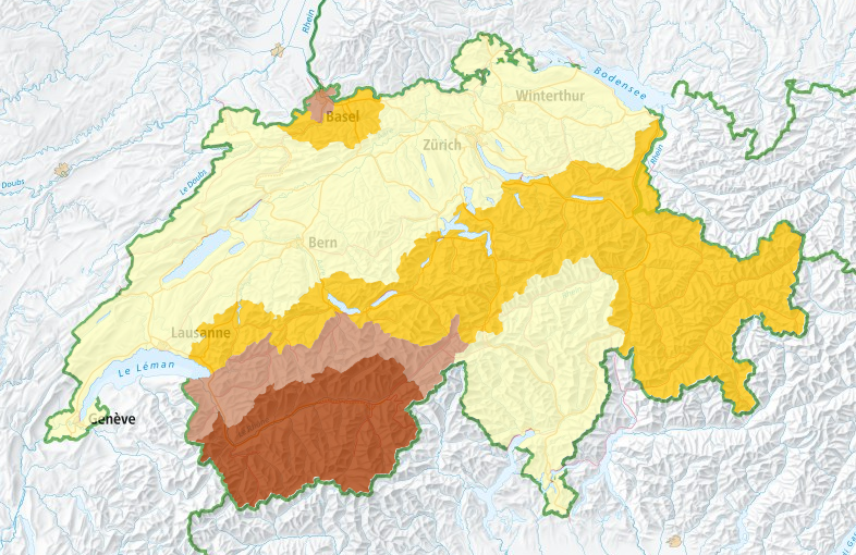
Seismic Hazard Switzerland
In Switzerland, earthquakes are the natural hazard with the greatest potential for causing damage. They cannot currently be prevented or reliably predicted. But, thanks to extensive research, much is now known about how often and how intensely the earth could shake at a given location in the future.
Switzerland’s seismic hazard model is a comprehensive representation of this knowledge. It makes a forecast of potential earthquakes and the resulting ground motions over the next fifty years. The model is based on knowledge of tectonics and geology, information about the history of earthquakes, damage reports, and wave propagation models. Experts and authorities use it as a starting point when making decisions regarding earthquake mitigation and risk management. The Swiss seismic building codes are also based on this model.
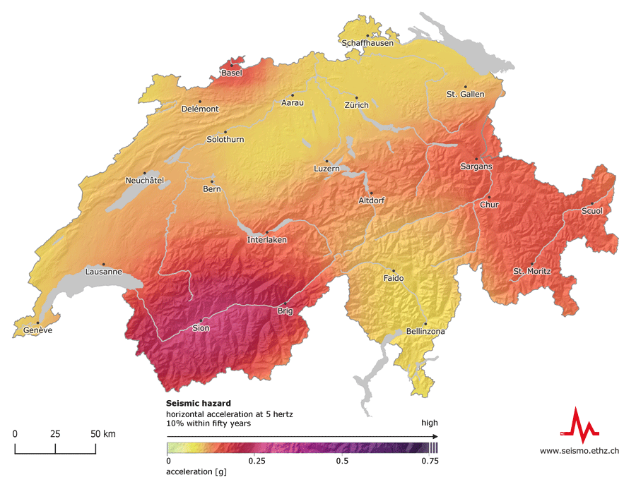
The estimate of the regional distribution of Switzerland’s seismic hazard has not changed substantially in the last ten years: Valais remains the region with the highest hazard, followed by Basel, Grisons, the St. Gallen Rhine Valley, Central Switzerland, and the rest of Switzerland. But, compared to 2004, Grisons now shows a slightly higher hazard, and expected ground motions are also slightly stronger than previously expected across Switzerland in several frequency ranges.
Switzerland’s seismic hazard model 2015 replaces the previous model from 2004. A periodic update reflecting the latest technological and scientific findings forms the basis for adequate protection measures. The seismic hazard model 2015 features new data, revised estimates of historical sources, a homogeneous reference rock, and improved predictive models. The uncertainty regarding estimates of likely ground motions has been significantly reduced relative to the 2004 model, meaning the 2015 model provides a more solid estimate of seismic hazard and a good basis for a nationwide risk model.
Interactive Map Tool
Consult a variety of different maps using our interactive map tool to find out how likely certain earthquakes are in Switzerland:
- The hazard maps show how often buildings are affected by certain incidents of horizontal acceleration.
- The effects maps focus on the likely consequences of an earthquake.
- The magnitudes maps show how often earthquakes of a particular strength occur.
