News Archive 2013
2013-12-12
Earthquake in Liechtenstein
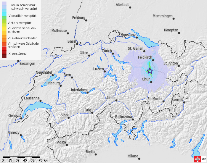
On December 12th, 2013, at 01.59 (local time) an earthquake at a depth of 7 km occurred near Sargans (SG).
Over 500 people have submitted a 'felt report' to the Swiss Seismological Service. The earthquake was felt over large areas of the German part of Switzerland as well as in Liechtenstein and Vorarlberg. Additionally, some reports arrived from the Western part of Switzerland. No damage is usually expected for an earthquake of this magnitude.
At almost the same place, an earthquake of magnitude 3.6 occurred on February 23rd, 2000.
According to initial findings there is no correlation to the geothermal project in St. Gallen.
Earthquake chronology geothermal energy project in St. Gallen
2013-10-24
Small earthquake near Saxon (VS)
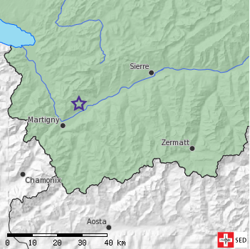
In the late evening of 23 October 2013 at 22:42 local time a small earthquake occurred north of Saxon (VS) close to Ovronnaz. The event with magnitude 2.4 happened at shallow depth and therefore was clearly felt within a radius of about 5 km. Around 25 people reported the event to the Swiss Seismological Service. The reports indicate that the earthquake was often felt like a strong explosion.
Such observations are typical for small earthquakes within the first few km of the earth. From an earthquake of this magnitude no damages are expected.
2013-10-10
Sonic boom and not an earthquake
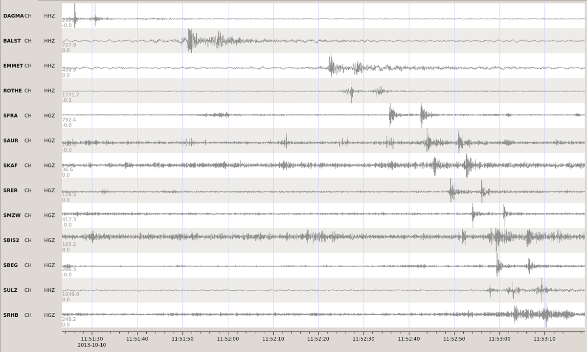
On 10 October, 2013 shortly before 2 pm local time, numerous seismic stations operated by the Swiss Seismic Network recorded an unusual signal across NE Switzerland. Two impulsive signals roughly 7 seconds apart spread slowly from near Lucerne towards Basel. A careful analysis of the signals showed they could not be produced by an earthquake or a quarry blast. Judging by the velocity the signal moved across the region, a more likely explanation would be a sonic boom produced by a Jet or a meteorite.
The Swiss Air Force have since confirmed that there indeed were two aircrafts flying across the region at supersonic speeds at this time. Judging by the felt reports submitted to the SED website, the pressure waves produced light shaking that was particularly strongly felt in Kanton Aargau.
The image on the top shows the waveforms recorded by Swiss seismic stations showing the seismic boom from the two aircraft as two separate signals roughly 7s apart.
2013-09-11
New: Up-to-the-Minute Earthquake Notifications on Twitter
Would you like to be immediately informed in the event of an earthquake in Switzerland or its neighboring countries? Then follow us on Twitter! The Swiss Seismological Service (SED) reports every earthquake with a magnitude of 2.5 or greater on its Twitter account. It is only from around this strength that earthquakes can be perceived by humans. Through our tweets, you can immediately find out when and where there was an earthquake, how strong it was, and if there is a possibility of resulting damage. Additional news from the SED as well as detailed information on individual earthquakes will still be available on our website.
Follow us at SeismologicalService@seismoCH_E at

2013-08-30
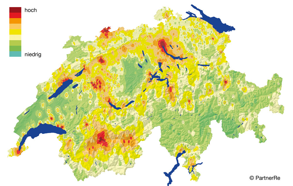
Earthquake risk tool
Every year, between 500 and 800 earthquakes occur in Switzerland. Around 10 of those are strong enough (magnitude of approximately 2.5 or above) to be noticed by the population. On average, the Swiss Seismological Service registers two earthquakes per day in Switzerland and neighboring countries.
Earthquakes with a magnitude of 6 or more are rare (approximately every 100 to 150 years) but can occur anywhere in Switzerland and at anytime. 90 percent of buildings here are of unknown or insufficient earthquake safety, which is why extensive damage is to be expected in case of such an earthquake.
2013-08-29
Scientifica 31. August bis 1. September 2013
Gibt es in der Schweiz Erdbeben, die merkliche Schäden anrichten? Wie kann ich mein persönliches Erdbebenrisiko abschätzen? Und wie schütze ich mich vor Erdbeben? Antworten auf diese und weitere Fragen bietet der Beitrag des Schweizerischen Erdbebendienstes an der Scientifica.
Sie finden uns im NO Gebäude im C Stock, wir freuen uns auf Ihren Besuch! Die Scientifica öffnet ihre Tore am Samstag von 13:00 bis 20:00 Uhr und am Sonntag von 11:00 bis 17:00 Uhr.
Kurzvorlesungen zum Thema Erdbeben an der Scientifica:
- Erdbebenrisiko Schweiz: Die vergessene Gefahr?
- Von der Schwierigkeit der Kommunikation bei Erdbeben: das Beispiel Aquila 2009

2013-07-31
Earthquakes: Geothermal Energy Project in St. Gallen
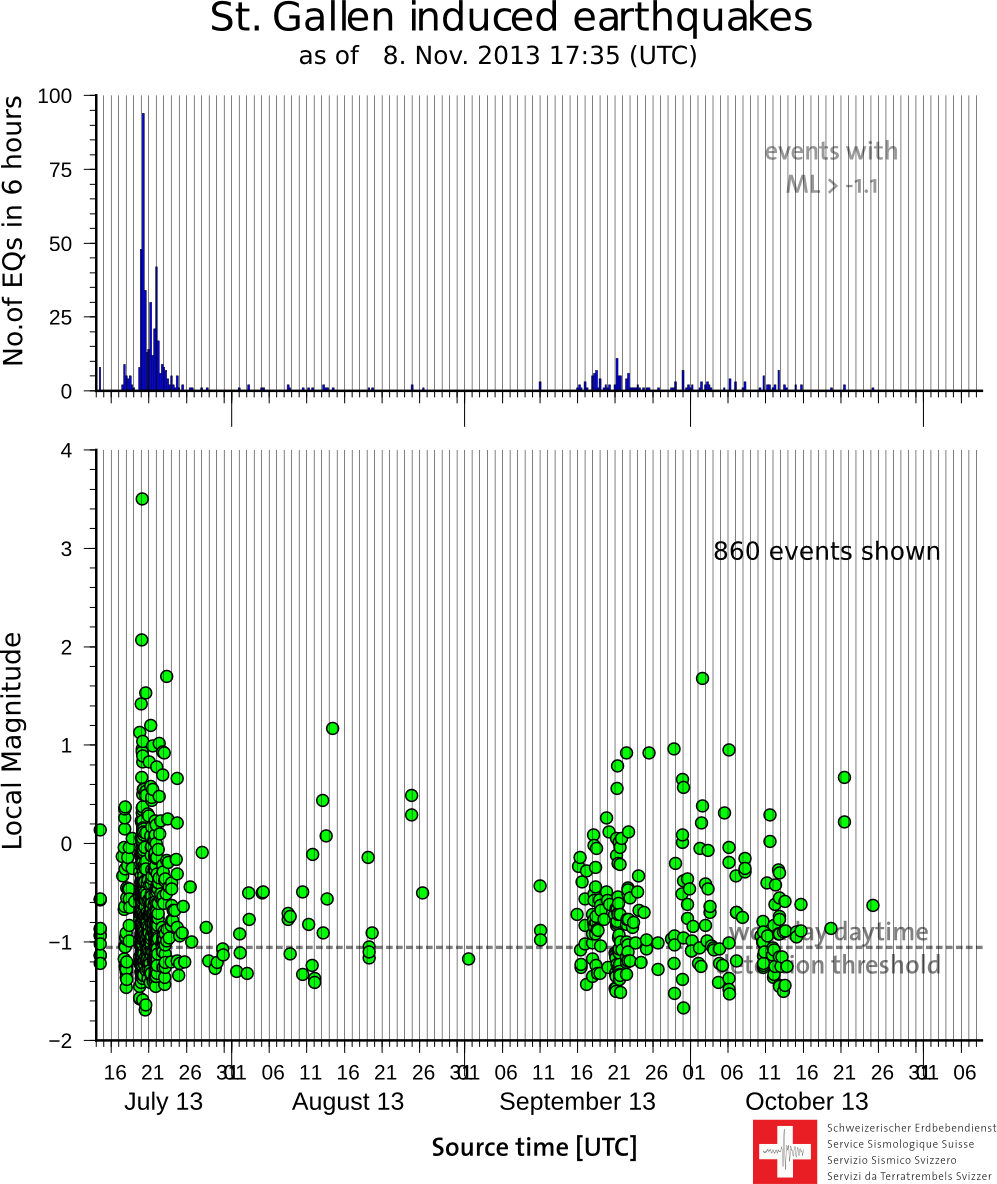
The test and stimulation activities carried out as part of the planned geothermal energy project in Sittertobel near St. Gallen began on July 14, 2013. The number and intensity of the microearthquakes induced were as expected and not noticeable to local residents. On the evening of July 19, seismic activity began to increase; the earthquakes became stronger and more frequent. The sequence achieved the highest peak so far on the morning of July 20, with a perceptible quake with a magnitude of 3.5. According to the latest findings, these earthquakes are directly linked to the steps taken to tackle the gas-water leak observed at midday on July 19.
Read more...Since then, seismic activity has fallen steadily. However, stronger quakes can still not be ruled out. The Swiss Seismological Service (SED) continues to monitor seismic activity in St. Gallen around the clock with the help of a dense, local network.
The SED is currently analyzing the data collected in order to gain a better understanding of the processes responsible for the observed earthquakes, and to then possibly derive forecasts for the further course of these and other quake sequences.
Additional information can be accessed via the following links:
Background information on seismic monitoring of the geothermal energy project in St. Gallen
Geothermal energy project website of the St. Gallen public utilities company (Sankt Galler Stadtwerke)
2013-07-22
Earthquake near Zernez
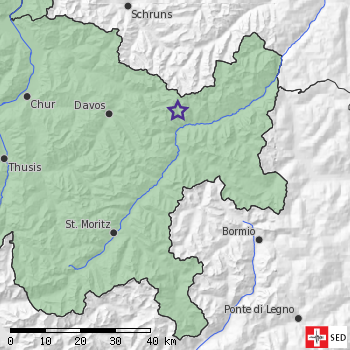
On the evening of July 20, 2013, an earthquake occurred near Zernez (canton of Graubünden) at around 9.50 p.m. The earthquake, which measured at 2.6 on the Richter magnitude scale, was felt by several people in the region. It is not anticipated that earthquakes of this magnitude cause any damage.
2013-07-03
Earthquake between Moutier and Delémont
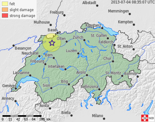
On July 3, 2013, at 4.13 pm, an earthquake with a magnitude of 3.3 occurred between Moutier and Delémont at a depth of 25.5 km. The earthquake was felt at distances up to about 30 km. Earthquakes of this magnitude generally do not cause any damage.
2013-07-01
Small Earthquake in Basel on 29. June 2013
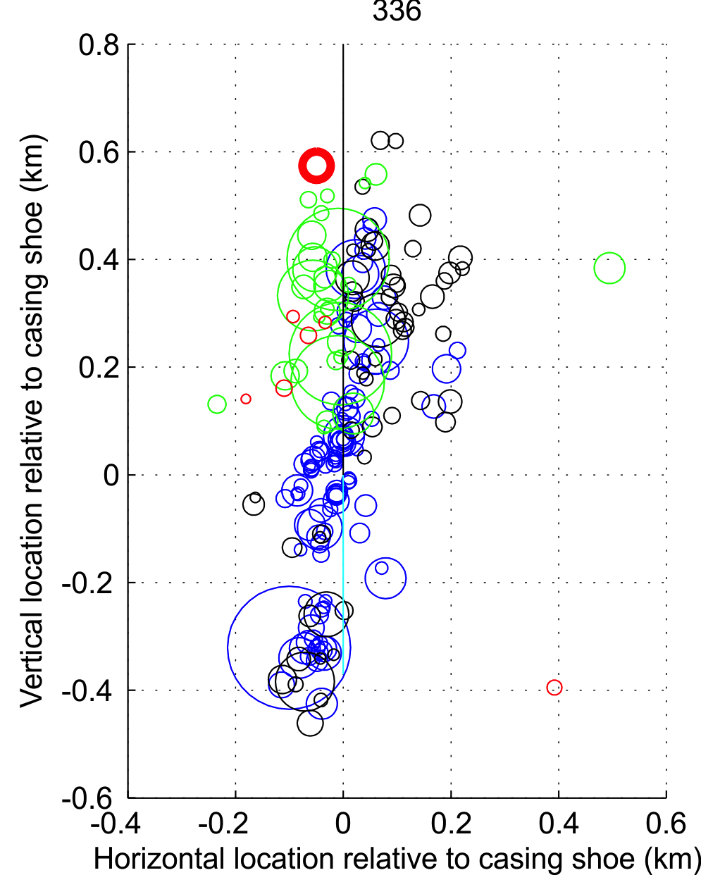
On Saturday, 29 June 2013 at 11:11 local time the SED recorded an earthquake of magnitude 1.7 in Basel. The earthquake occurred very close to the site of the now terminated deep geothermal project (Deep heat mining DHM Basel) at a depth of approx. 4 km (based on relative relocation using previous events). It was sporadically felt in Basel but did not cause any damage.
Read more...Saturday's event is directly related to the region stimulated in December 2006, as comparison with earlier events induced by the hydraulic stimulation of the DHM project in December 2006 show. This event is the strongest to occur in the geothermal project reservoir area since November 2007.
The occurrence of such micro-events is not unusual. Model calculations show that the seismic activity in the stimulated area will decrease continually, but that it will take approximately between 8 to 15 years until it returns back to pre-stimulation levels. Similar events will occasionally occur during this period.
The image shows the location of the event (bold red circle) relative to earlier events in a depth cross-section looking north-northwest and centered on the bottom of the borehole casing. Blue: Events during the stimulation 2006; black: after the termination of the stimulation in Dec. 2006; green: events in 2007; red: events in 2010, 2012, 2013. The circle diameter scales with earthquake magnitude.
2013-06-21
30 New Stations of the Strong Motion Network Online
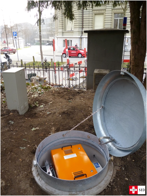
In a project divided into two phases, Switzerland is in the process of modernizing and expanding its strong motion network. The stations of the network are suitable, above all, for recording relatively strong earthquakes. They are located primarily in the densely populated regions of Switzerland and in areas with elevated seismic hazard.
Read more...On June 24, 2013, the last of 30 strong motion network stations of the first phase went online and, since that time, has continuously been transmitting data to the Swiss Seismological Service in Zurich. These data are used to assess the current seismicity and the site-specific ground movement during earthquakes. In addition, geophysical measurements will be used at each of the sites to determine the characteristics of the geological subsurface and ascertain how it behaves in the event of an earthquake. This site characterization of the 30 new stations will be completed by the end of the year.
Work on the second phase, which involves the installation of another 70 stations by 2018, began in June of this year. It is funded by the Federal Office for the Environment.
Further information on the modernization of the strong motion network
2013-06-21
Earthquake South of Parma
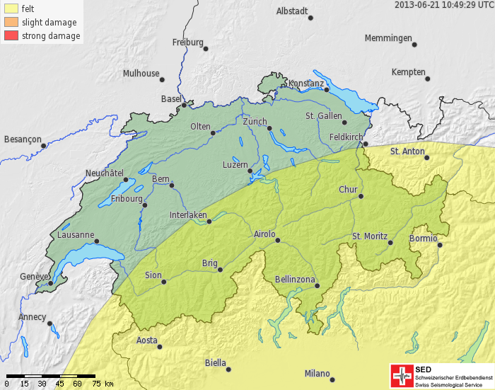
On Friday, June 21, 2013, at 12:33 p.m., an earthquake occurred approximately 70 kilometers south of Parma, Italy. With a magnitude of 5.2, it was strong enough to be felt in large parts of southern Switzerland (see the “estimated shaking extent” map to the left). The earthquake was felt particularly strongly in the upper stories of buildings. In the event of earthquakes of this magnitude, minor to moderate damage near the epicenter can be expected.
In spring last year, several earthquakes struck the Emilia-Romagna region not far from Parma, causing in some cases major damage. The tremors then were also felt in large parts of Switzerland.
2013-05-28
New Director of the Swiss Seismological Service
Professor Stefan Wiemer is the new Director of the Swiss Seismological Service (SED). The Executive Board of ETH Zurich has appointed the 46-year-old, who has been interim Director since January 2012, to succeed Professor Domenico Giardini.
Read more...Stefan Wiemer will be responsible for further pursuing the manifold activities and mandates of the SED as the federal institute for seismology. The core objectives of the SED are seismological monitoring and hazard assessment in Switzerland. For Stefan Wiemer, communicating knowledge about seismological activity is particularly important. This means informing authorities, media and the public appropriately and comprehensively, as well as educating students. Additionally, Stefan Wiemer wants to create space for pursuing new developments. “The increased use of geo-energy also presents challenges to the SED, and I am really looking forward to meeting them head on”, says Stefan Wiemer.
Stefan Wiemer attained a diploma in geophysics from the Ruhr University Bochum (D) in 1992. In 1999, after his PhD at the Fairbanks University in Alaska (US) and his postdoc studies in Tsukuba (Japan) he moved to the SED as a research associate, where he set up and led two research groups. He then took over as interim Director in January 2012. The ETH Board just appointed him as Full Professor of Seismology. “We are very pleased to have Stefan Wiemer as the new Director. He brings a wealth of experience and in-depth knowledge of the SED”, says ETH President Ralph Eichler. “This ensures continuity in an institute of great importance to the whole of Switzerland.”
Earthquake hazard as a specialist field
Stefan Wiemer researches the effects of earthquakes and investigates which processes in the earth’s crust trigger earthquakes. His research interest also include time dependent hazard assessment, which analyses whether it is possible to make more precise forecasts based on micro-seismic data. In the last ten years, he and his team have developed new methods and software solutions for analysing the quality of data catalogues that collate all the earthquakes recorded in a country. Since the 2006 geothermal project triggered earthquakes in Basel that were distinctly felt, Stefan Wiemer has also been working on tremors caused by human activity.
As an expert on seismic hazard, Stefan Wiemer is a member of numerous committees and provides professional reports, for example, as part of the “PEGASOS” studies on earthquake hazard analysis for Swiss nuclear power plants. He was also responsible for the calculation of the Swiss earthquake hazard map in 2004. At the ETH Zurich he supervises numerous master and doctoral theses and gives lectures in Seismology and Earth Sciences.

2013-04-23
Earthquakes: second largest risk for Switzerland
The Federal Office of Civil Protection (FOCP) analyzed the effects of different catastrophes and emergencies in Switzerland. According to the "Risikobericht 2012" (no English version available) earthquakes are considered to be the second largest risk for Switzerland followed by large scale power blackouts. Pandemics take the first position. Even though earthquakes pose the biggest potential for damage among the analyzed hazards they occur less often than other catastrophes and emergencies.
2013-03-08
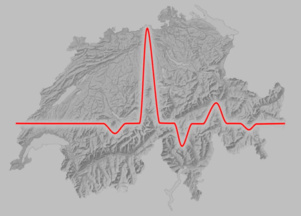
Demolition of the Sprecherhof in Aarau recorded by seismographs
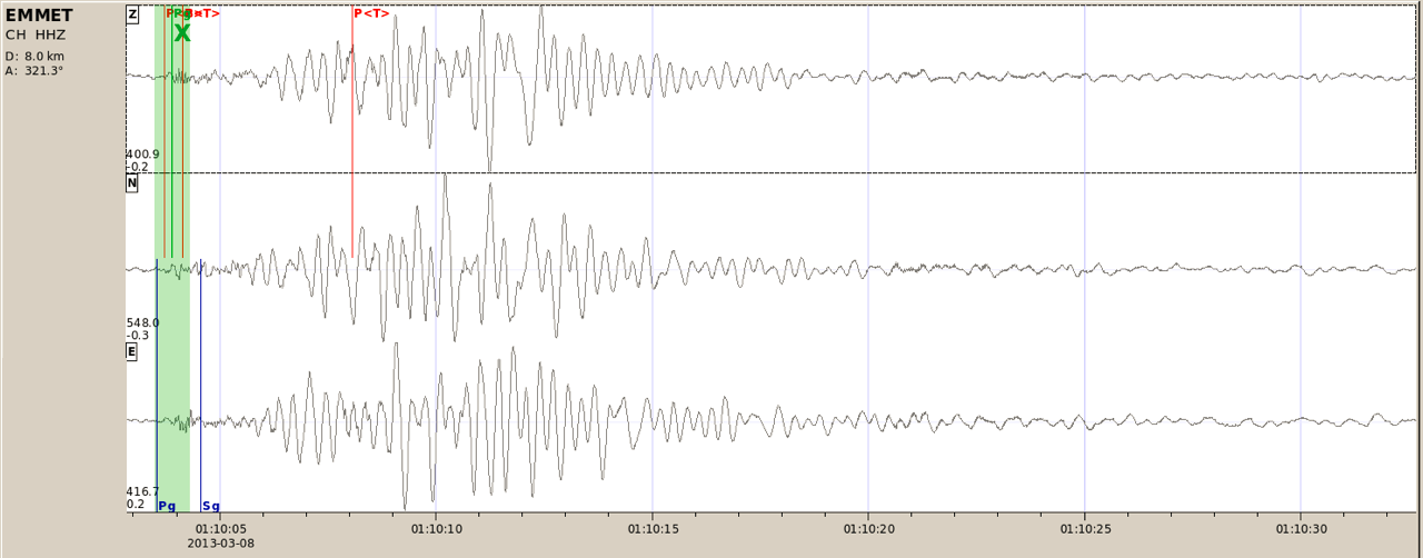
The rare event of a controlled demolition of a structure in Switzerland was captured by the sensitive seismic stations of the Swiss Seismic Network. As the figure shows, shortly after 02:10AM (01:10 UTC) early Friday morning (8 March 2013), seismic waves produced by the explosions and the resultant collapse of the Sprecherhof building are clearly visible at the station EMMET located only 8 km from Aarau.
2013-02-13
North Korean nuclear test also recorded in Switzerland
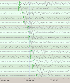
The seismic waves generated by the North Korean nuclear test on February 12, 2013 (02:57 UTC, 03:57 Swiss local time) reached the seismic monitoring stations in Switzerland approximately 12 minutes later. That this event was an explosion rather than an earthquake can be deduced from the seismic waveforms. For an explosion the amplitude of the first arriving P-wave is relatively stronger than the later arriving S-Wave, compared to an earthquake.
Read more...The power of the explosion corresponds to an earthquake magnitude of 5, thus this test was significantly stronger than the two previous ones in 2006 (magnitude 4.1) and 2009 (magnitude 4.5). The location of the event in the North Korean province Northern Hamgyong as determined by the Comprehensive Nuclear-Test-Ban Treaty Organization (CTBTO) and confirmed by other global seismological agencies, suggests that the test of February 12, 2013 took place at the same location as the previous ones.
The SED station DAVOX near Davos (GR) is the Swiss contribution to the currently 146 seismic stations of the CTBTO's International Monitoring System.
Further information on the nuclear test from CTBTO
General information about verfication of nuclear test explosions from the SED
2013-01-31
Earthquake mitigation: the Federal Government continues its program of measures
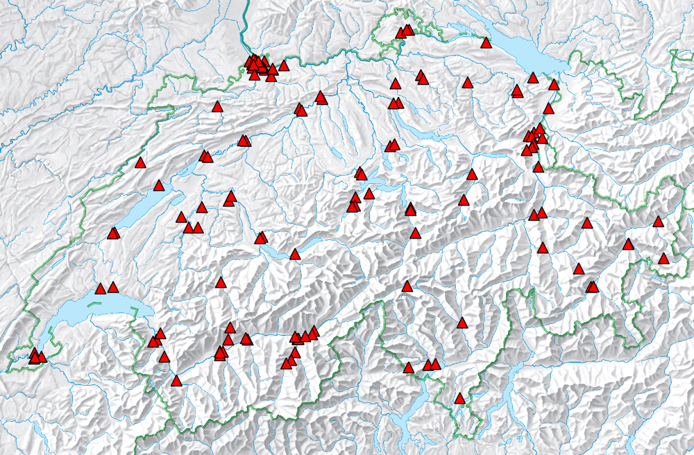
The earthquake preparedness in Switzerland should be further improved. The Federal Council has defined the focus areas in the program of measures for earthquake mitigation for the period 2013 to 2016. One element is the renewal of the strong motion network. In the now approved second stage of the project, the Swiss Seismological Service (SED) will install 70 additional stations until 2018.
Download SED sectoral report (in German only)
Further information about the program of measures (BAFU) and the second stage of the renewal of the strong motion network (SED) (in German only)
2013-01-24
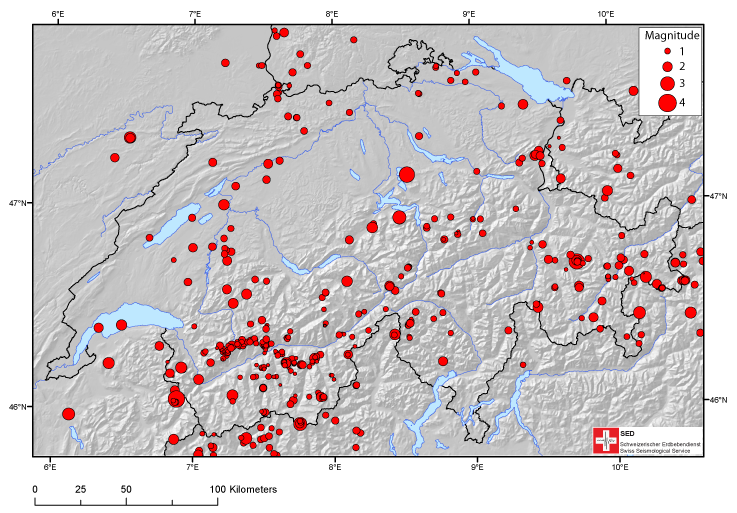
Earthquakes in Switzerland in 2012: a review
In 2012, the Swiss Seismological Service registered around 500 earthquakes in Switzerland and its neighboring countries. The magnitude of these earthquakes ranged between 0 and 4.2 on the Richter magnitude scale. Even though the strongest tremor was larger by one unit of magnitude than the strongest one from 2011, earthquake activity in Switzerland was relatively low in 2012. There were only 13 earthquakes with a magnitude of a minimum of 2.5 in comparison to an average of around 23 events over the past 37 years.
Five earthquakes were clearly felt by the population: among them were the two tremors in the region of Filisur on 1 and 2 January (magnitudes of 3.3 and 3.5), the two in Zug at the beginning of February (magnitudes of 4.2 and 3.5), as well as the single tremor in Vallorcine, between Martigny and Chamonix, at the end of October (magnitude of 3.6). The Filisur tremors were part of of a series of 10 tremors at the same location. The one from Vallorcine is part of ongoing seismic activity, which, in September 2005, recorded its most notable tremor to date, measuring 4.9 on the Richter magnitude scale. Generally speaking, the earthquakes in 2012 were concentrated in Valais and the canton of Graubünden, not unlike past years. Furthermore, increased activity was recorded for Central Switzerland.
