News Archive 2012
2012-12-21
Bhutan: a Country with Many Unknowns
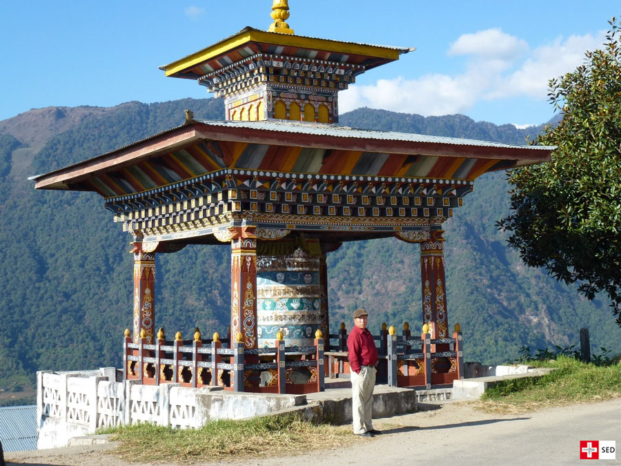
Numerous myths surround the Kingdom of Bhutan, which is located in the eastern Himalayas and declares the right to happiness in its constitution. The geographic isolation and the self-imposed cultural demarcation contribute to long-lasting legends. One of these may be that Bhutan has a comparatively low seismic hazard and seismic activity. The country has, in fact, been spared larger earthquakes over the past 120 years, even though it is surrounded by seismically active areas. To find answers to these and other questions, the Swiss Seismological Service (SED), in collaboration with the Seismology and Geodynamics group at ETH Zurich, will be installing and maintaining a temporary seismic network in Bhutan in 2013.
Read more...This research project, funded by the Swiss National Science Foundation (SNF), is conducted with strong support and participation from our Bhutanese colleagues, who intend to utilize the data for further projects (e.g. developing a seismic hazard map). The long-standing friendly relationship with the Geology and Mines Bureau of Bhutan ensures a sustained exchange beyond the project duration.
You can find additional information on the GANSSER project here
2012-12-18
Local Time or UTC?
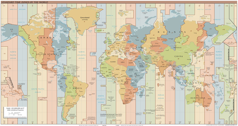
In the past, anyone in Switzerland who felt an earthquake and looked at the clock might well have been confused to find a quite different time quoted at the website of the Swiss Seismological Service. In winter, there was a one-hour difference from local time, which became two hours in summer, as the website has previously only quoted times in Coordinated Universal Time (UTC). That standard time format helps seismologists and other scientists to investigate occurrences regardless of the relevant time zone.
To eliminate further confusion, our website now quotes the times of all earthquakes occurring in Switzerland and adjacent countries in both local time and UTC. Times of earthquakes in other countries continue to be listed only in UTC, for ease of international comparison.
2012-10-25
Minor Earthquake between Martigny and Chamonix
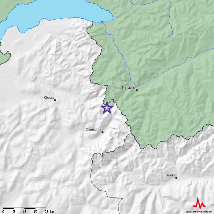
In the night of 25 October at 03:11 local time a small earthquake occured in the French-Swiss border region between Martigny VS and Chamonix. The tremor with a magnitude of 3.6 was located at shallow depth and was likely felt in the canton Valais and in the Lake Geneva region. No damage is expected from an earthquake this size.
As you may have realized, our website was intermittently off-line on 25 October. This was due to a technical problem affecting the whole ETH which has meanwhile been resolved.
2012-10-17
New software system for detecting and locating earthquakes
On Monday, October 22, the SED will migrate to SeisComP3, a new software system for detecting and locating earthquakes. SeisComP3 is a comprehensive new software developed by GFZ Potsdam and gempa GmbH. Following the transition, the earthquake information on the SED website will be provided from this new system. However, the content of the current earthquake catalog will not change, algorithms for locating earthquakes and calculating magnitudes remain the same, and the layout of the webpage is not affected. Due to the move, over the coming days, users of this website may expect short hiccups in service or missing elements on the maps and lists providing earthquake information. We will try to fix upcoming problems as soon as possible.

2012-09-24
Annual report 1996 - 2011 now online
The SED annual report on the seismic activity in Switzerland from 1966 to 2011 is now available for download. The document contains each individual yearly report since 1996 and includes an updated overall summary.
2012-09-20
Seismological monitoring of the geothermal project in St. Gallen
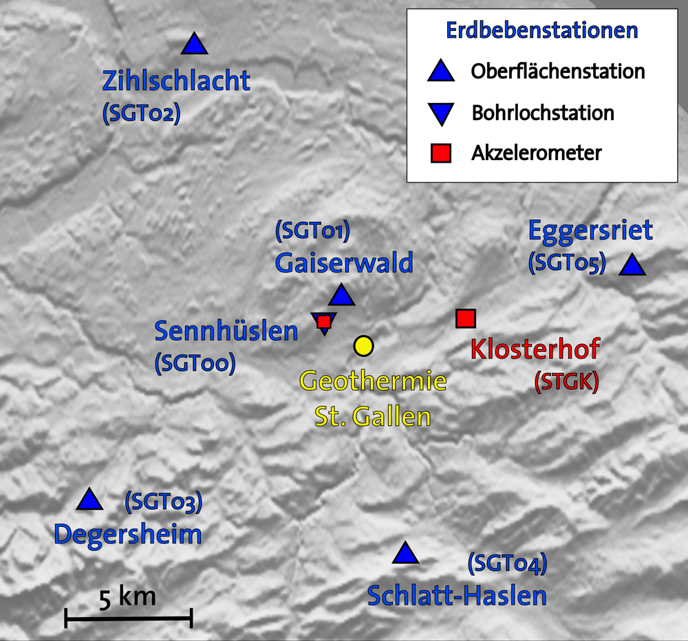
The city of St. Gallen is planning to exploit a suspected geothermal aquifer at a depth of approximately three to four kilometers below the city. Starting in December 2012, a first bore hole will be drilled and is estimated to reach its target depth in about three months time.
In the framework of the research project GEOBEST, the Swiss Seismological Service (SED) is operating a seismological system to monitor the geothermal power project. The SED in cooperation with the community services of St. Gallen has installed six new seismological stations in the area.
2012-09-17
SED Field Campaign on Rhonegletscher in the Swiss Alps
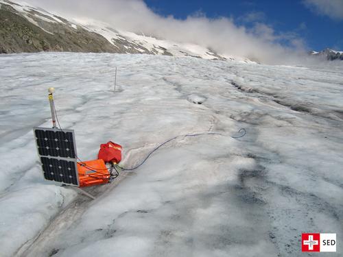
The Swiss Seismological Service is investigating the dynamical behavior of the Rhonegletscher, focussing specifically on changes in the subglacial drainage system. This project is conducted in partnership with two other research teams from ETH. The data collected through multiple measurement techniques help to understand how various factors, climate change and glacier retreat, impact the dynamical behaviour of the glacier.
Read more...Since May 2012, the SED operates three shallow borehole seismometers on the Rhonegletscher, VS. This installation is part of a larger field campaign of the SED, the glaciology group at the VAW (Laboratory of Hydraulics, Hydrology and Glaciology, ETH Zurich), and the EEG (Exploration and Environmental Geophysics) group at the Institute of Geophysics, ETH Zurich to study the dynamical behavior of the Rhonegletscher.
During the main field deployment in September 2012, the glaciologists of the VAW will drill deep boreholes to the glacier bed, while the EEG group will conduct active seismic experiments. The SED will install additional ten seismometers on the surface of the Rhonegletscher. In combination with the already installed shallow borehole seismometer the seismological array will monitor icequake activity on the Rhonegletscher. Icequakes are seismic sources within a glacier, which occur due to opening and closure of crevasses, movement of fluids (hydrofracturing), and coupling of the glacier to his bed.
By locating and studying icequake source mechanisms, including their temporal and spatial evolution, important insights into the flow dynamics of the Rhonegletscher can be gained. In combination with data acquired by the VAW group and the EEG group a unique data set of different measurements on the Rhonegletscher will be acquired. This data set will help to improve our understanding of an Alpine glacier’s dynamical behavior in relation to changes in the subglacial drainage system caused by climate change and glacier retreat, also affecting the Swiss Alps.
2012-09-04
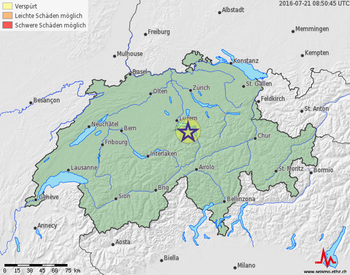
Small Earthquakes in Central Switzerland
In the morning of 4. September 2012, at 03:06, 04:51 and 07:13 local time, three small earthquakes occurred near Lake Lucerne (Vierwaldstättersee). All quakes are located at almost 10 km depth a short distance south of Beckenried. The two later ones with magnitudes of 2.8 and 2.9 were partly felt in the vicinity. Earthquakes of this magnitude do not cause damage.
A few kilometer north a similar event with magnitude 3 in 10 km depth was registered on 17. August 2000.
2012-06-26
Development of the Emilia-Romagna earthquake sequence
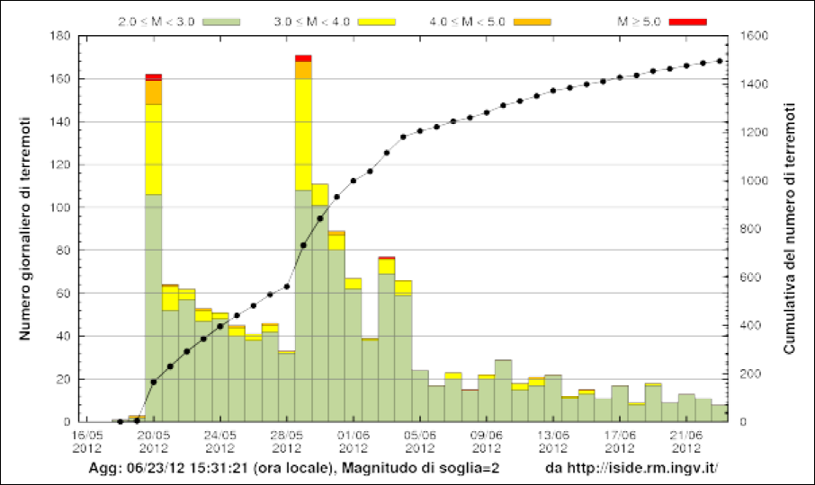
The earthquake activity in the Po Valley in the Emilia-Romagna region has decreased over the last couple of weeks, a typical development of an earthquake (aftershock) sequence.
Earthquakes are still recorded every day, most of them with Magnitudes below 3 and thus too weak to be felt. Information about the current situation can be found at the INGV Blog (in Italian).
So far no significant increase of earthquake activity was observed in the wider area or on the coast of the Adriatic. A map of the recent earthquake activity in Italy can be found here.
Read more...Nevertheless further earthquakes, even stronger ones, might occur in the future and again cause damages. In general the earthquake hazard in Italy is higher than in Switzerland.
In both countries, however, strong earthquakes may occur at any time anywhere, independent of the current events.
The SED cannot provide any advice concerning travel in the region. In the central and eastern Mediterranean region earthquakes may occur anytime.
The Italian Tourism Office provides further information about the earthquake effects in the Emilia-Romagna region.General information about earthquake hazard and risk in Italy is provided by Protezione Civile in English and Italian.
Links:
Blog INGV (in Italian)
Map recent earthquake activity Italy
Civil Defense (Protezione Civile)
2012-05-24
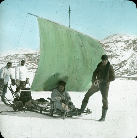
Crossing the Greenland Ice – 100 Years of Swiss Science in Greenland
100 years ago, in 1912, a Swiss team crossed the Greenland ice sheet, covering a distance of 700 km. The four-man expedition was led by Alfred de Quervain, latterly the Director of the Swiss Seismological Service (SED). An exhibition at the focusTerra museum highlights both the historical and modern pioneering efforts of ETH scientists in Greenland.
Opening on Thursday June 14 at 18.00 at NO C60, Sonneggstrasse 5.
2012-06-06
Continuing aftershock activity in Italy and travel to the region
Aftershocks are expected to occur in the affected region within the next days and weeks. Their frequency and intensity will decrease over time, although the exact pattern of the earthquake sequence is not predictable. We cannot exclude the possibility of additional damaging earthquakes occurring within the coming days.
Read more...The SED does not provide any advice concerning travel in the region. According to the Minister for Tourism in Emilia-Romagna, there has been no damage at any tourist facilities. "Hotels, restaurants, beach clubs, bars, etc are fully operational from north to south- from Po Delta to Ravenna, Rimini all the way down to Cattolica. All the connecting arteries - flights, motorways, trains - are running normally." Further information from the regional tourist board can be found here. Nevertheless in the villages which sustained significant damages, some restrictions in daily routine should be expected.
Reflecting our analysis, the earthquake risk in a broad region around the epicenter has not been raised by the recent earthquakes. But stronger aftershocks could be felt in the entire northern part of Italy.
2012-05-21
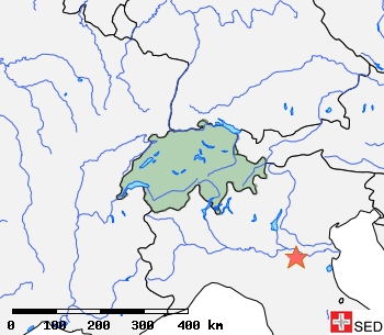
Earthquake in Northern Italy – a summary
On Sunday, 20 May 2012, at 04:04 local time an earthquake of magnitude 6 (INGV: M 5.9, USGS: M 6.0, EMSC: M 6.1) occurred in the Emilia Romagna region between the towns of Modena, Ferrara and Bologna. This earthquake was preceded by a magnitude 4.1 foreshock at the same location at 01:45.
The mainshock was followed by numerous aftershocks, the strongest so far with a magnitude 5.1 on Sunday afternoon at 15:28. The main event as well as some aftershocks led to partly severe damage in the vicinity of the epicenter. The shaking from the earthquake could be felt in large parts of Switzerland. It must be expected that within the next days and weeks aftershocks will continue, including strong ones.
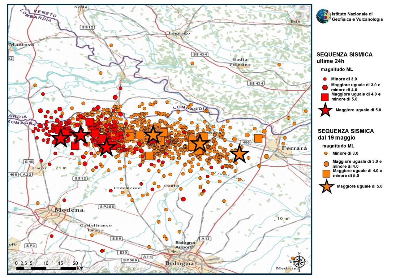
The spatial distribution of the nearly 200 aftershocks registered until midday of 21 May in an east-west oriented zone of approx. 40 km length that reaches until Ferrara in the east is likely the expression of the rupture area activated by the mainshock.
The last larger earthquake in the region occurred in 1987 approx. 20 km south of the main event of 20 May and had a magnitude of 5.4. The earthquakes in this region of the Po-plain can be attributed to compression between the Alps and Appenines, which is related to the collision of the African and European plates.
Further information can be found on the INGV websites (IT) and at the USGS (EN).
2012-05-20
Erdbeben in Norditalien
Ein Beben mit Magnitude 6.1 hat um 04:04 Uhr Lokalzeit am Sonntag, 20. Mai 2012, die Region Emilia Romagna erschüttert. Das Epizentrum befand sich ca. 30 km westlich von Ferrara. Bei einem Beben dieser Stärke ist mit verbreiteten Schäden, nahe des Epizentrums auch mit grossen Schäden, zu rechnen.
Das Beben wurde in weiten Teilen der Schweiz verspürt.

2012-05-07
Seismo 12 – Practicing for a real seismic crisis
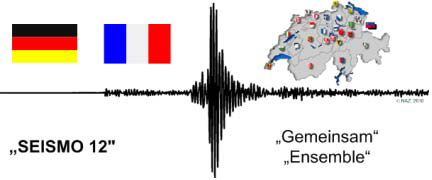
From May 8 to May 10 the Swiss Seismological Service will take part in a simulation of a large earthquake. In particular, the SED will test its cooperation with several federal and cantonal agencies. French and German organizations are also participating. The Swiss Federal Office for Civil Protection (FOCP / BABS) will coordinate the exercise. The scenario event is a repeat of the 1356 Basel earthquake sequence, which includes a magnitude of 6.6 mainshock accompanied by several large foreshocks and aftershocks.
"Wissen aktuell" radio report.
2012-05-18
Vierter Schweizerischer Geologentag – Beben und Bewegen
Wachsende Bevölkerungs- und Infrastrukturdichte sowie die induzierte Seismizität durch eine vermehrte Nutzung des Untergrunds erhöhen das Erdbebenrisiko in der Schweiz. Der mögliche Schadenumfang steigt, die Szenarien werden zum Politikum.
Der Schweizerische Erdbebendienst informiert am vierten Schweizerischen Geologentag im Rahmen der Fachmesse über seine Tätigkeiten rund um das Thema «BEBEN» (Stand Nummer 27).

2012-04-12
Earthquake off Sumatra
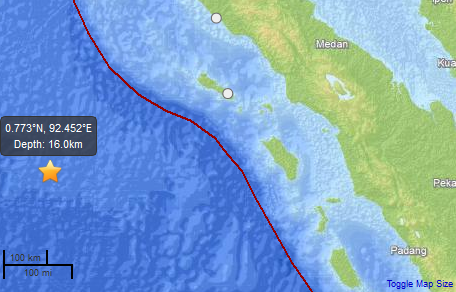
On April 11 2012 at 10.30 MESZ an earthquake with magnitude 8.6 occurred about 400 km west of the Indonesian island of Sumatra. This was the strongest earthquake to occur so far this year. As expected, there has been a vigorous aftershock sequence. As of 5pm CET on April 11, the strongest aftershock has had a magnitude of 8.2, occurring about 2 hours after the mainshock. The earthquake was felt across a very wide area, including South India, a distance of about 2000 km from the epicenter.
Read more...The national Tsunami Warning Centers in Indonesia, India, Thailand, Sri Lanka and the regional Pacific Tsunami Warning Center (PTWC) in Hawaii (who each monitor the Indian Ocean) issued tsunami warnings for the affected coast lines. The PTWC have subsequently withdrawn their warning.
Analysis of the earthquake recordings indicate that the sea floor moved predominantly in a horizontal direction. Due to the lack of significant vertical motion on the seabed, a major tsunami, as occurred in 2004, was not generated. A relatively large vertical sea floor displacement is necessary to produce a tsunami.
2012-02-24
Another earthquake near Zug
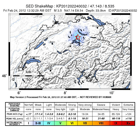
On Friday February 24 2012, at 1:32am, an earthquake of magnitude 3.5 occurred near Zug. This aftershock of the February 11 magnitude 4.2 earthquake was again located between Zuger- and Ägerisee at a depth of approximately 35 km. The earthquake was felt in parts of German-speaking Switzerland.
An earthquake of this magnitude and depth is not expected to produce any damage.
Have you felt the earthquakes? Please report it.
"Schweiz aktuell" report.
2012-02-12
Earthquake near Zug
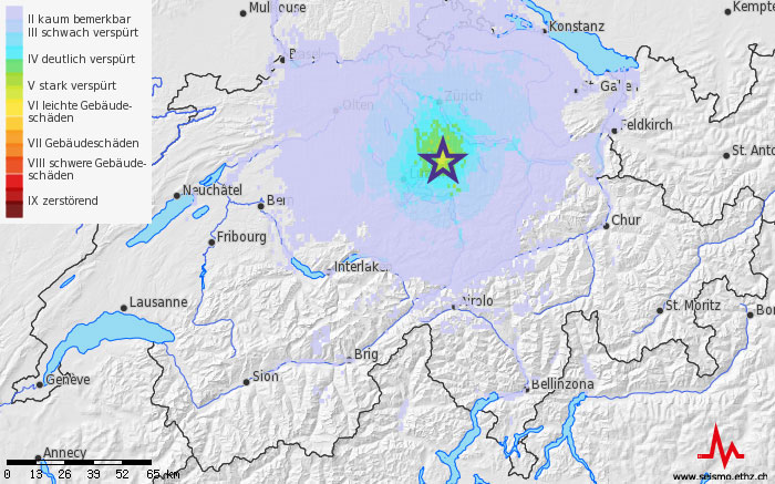
On Saturday, February 11 2012, at 11.45pm an earthquake of magnitude 4.2 occurred between Zuger- and Ägerisee at a depth of approximately 30 km. The earthquake has widely been felt in large parts of German-speaking Switzerland, the Bernese Jura and all the way to the Tessin. There are few reports about minor damages (fissures in walls and ceilings), however such damages are expected to be exceptional.
One small aftershock of magnitude 1.1 occurred on February 14 at 19:15. The aftershock wasn't strong enough to be felt. Until Wednesday afternoon no further aftershocks have been recorded.
- Background information about the earthquake can be found here.
- SF media report
2012-01-27
Another earthquake in northern Italy
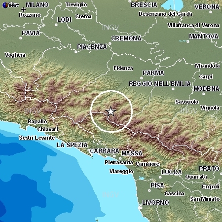
On Friday, 27 January, at 15:53 local time, the earth shook again in northern Italy. The earthquake with magnitude 5.4 occurred between Parma and La Spezia, currently it is estimated that the source was at a depth of 60 km.
Read more...The quake was a bit stronger and deeper than the one of 25 January, and therefore was felt more strongly and in a larger area also in Switzerland. Earthquakes of this magnitude are not unusual for this region.
Most probably there is no direct connection between this event and the one of 25 January, both are, however, related to the tectonic situation in the region of the Po-plane.
Further information is available on the website of INGV and the website of EMSC.
2012-01-25
Earthquake in northern Italy
On the 25th of January 2012 at 09:06 an earthquake of magnitude about 5 occurred in Italy, northeast of Parma. The event was strongly felt in northern Italy, and was also felt in large parts of Switzerland, particularly in the Ticino.
Read more...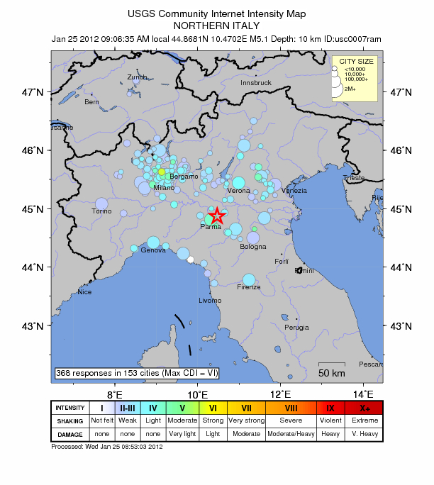
2012-01-09
Change at the Head of the Swiss Seismological Service
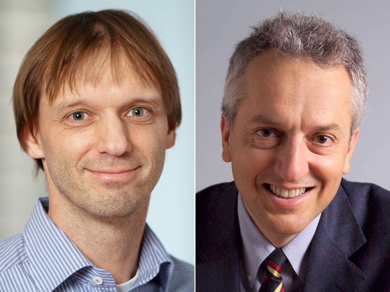
To the turn of the year professor Domenico Giardini stepped back from the leadership of the SED. Until a permanent replacement is in place the Executive Board of the ETH nominated Stefan Wiemer as ad interim director of the SED.
Read more...Since 1997, Domenico Giardini is Professor of Seismology and Geodynamics and was also Director of the Swiss Seismological Service, operated by the ETH on behalf of the Federal Government. During these years, he has coordinated numerous international research projects, and acted as a scientific expert on various National Commissions dealing with earthquake safety in urban areas and for critical infrastructures. He currently is the President of the International Association of Seismology and Physics of the Earth‘s Interior (IASPEI).
Domenico Giardini, who completed his Doctoral Studies at the University of Bologna, left the SED at the end of 2011, but will continue to serve as Professor for Seismology and Geodynamics at the ETH Zürich. "Domenico Giardini is one of the most recognised seismologist internationally and is largely responsible for the reputation of the Swiss Seismological Service as a centre of excellence for research as well as a crucial service for the Swiss public“, honored Roland Siegwart, the Vice President for Research and Corporate Relations at the ETH Zürich.
Until a permanently replacement is in place, Professor Stefan Wiemer will be the interim SED Director. Born in Germany in 1967, Stefan Wiemer was educated in Bochum and earned his PhD in 1996 at the University of Fairbanks, Alaska. He is at the SED since 1999 and for the past years has led the Earthquake Statistics group and has been Coordinator of the Hazard Center. In 2004, Stefan Wiemer and Domenico Giardini, together with a team from the SED, developed the current Swiss Earthquake Hazard Map, a critical tool for the risk management of Switzerland. Wiemer’s key research interests include induced seismicity and time dependent earthquake hazard, addressing the question of how can microseismicity be used to improved earthquake forecasts.
2012-01-06
Earthquakes in Switzerland in 2011: a review
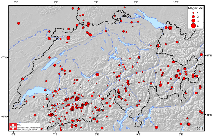
The Swiss Seismological Service manually located more than 500 earthquakes in Switzerland and the neighboring areas in 2011. The magnitudes of the events vary between 0.1 and 3.3 (local Richter magnitude). Even though the total number of registered earthquakes was higher than for the last three years, the earthquake activity in Switzerland and the neighboring regions in 2011 is comparatively low. While in the previous 36 years on average 24 earthquakes with magnitude 2.5 or higher occurred, only 10 such events were recorded last year. One has to go as far back to 1981 to find a year where the strongest earthquake had a smaller magnitude than in 2011.
Read more...Only three earthquakes were clearly felt: the two largest events in the sequence close to Sierre at the beginning of January 2011 (magnitude 3.3 and 3.2), and one close to Delémont (magnitude 3.1) between Christmas and New Year’s Day. The Sierre earthquakes were part of a sequence of 31 earthquakes that continued throughout the year, with 16 events occurring during the first five hours of the sequence. With a depth of 31 km the event near Bregenz on 27th January with magnitude 3.3 was so deep that it was barely felt by the public. As in former years the majority of earthquakes occurred in Valais and Grisons, while an elevated activity was also observed in Ticino.
The earthquake activity in 2011 does not suggest predictions for 2012 - during the first two days of the New Year, two felt events (magnitudes 3.2 and 3.5) occurred near Filisur, Grisons. In 2012, we will continue to supply the public with real-time earthquake information on our website, and wish you a tremor-free 2012!

2012-01-05
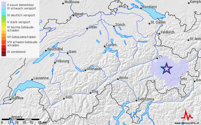
Small earthquake sequence close to Filisur GR
The Swiss Seismological Service registered since New Year's Day a series of small earthquakes northeast of Filisur, GR. The strongest earthquakes so far had a magnitude of 3.2 (1th January, 16:33 Swiss time) and 3.5 (2th January, 02:42). Both earthquakes were clearly felt by some people. Until the evening of 3th January the SED recorded 7 earthquakes in close proximity. The depth of the sources is not well constrained. The similarity of the recorded signals suggests, however, that all sources are located at approximately the same depth between 5 and 10 km below sea level, similar to previous earthquakes in this region.
For this region such earthquake sequences are not unusual. At this moment it can not be determined whether this sequence will continue for months as the ones in Sertig (2003) or Paspels (2007 - 2009) or if it will stop in the next few days.
The probability that a larger earthquake may occur in the near future is not significantly enhanced by this sequence.
The last stronger earthquake (magnitude 5) occurred in November 1991 in Vaz and caused slight damage to some buildings.
Even if stronger earthquakes (magnitude 5 to 6) happen only very rarely in Switzerland they may in principle occur anywhere anytime.
