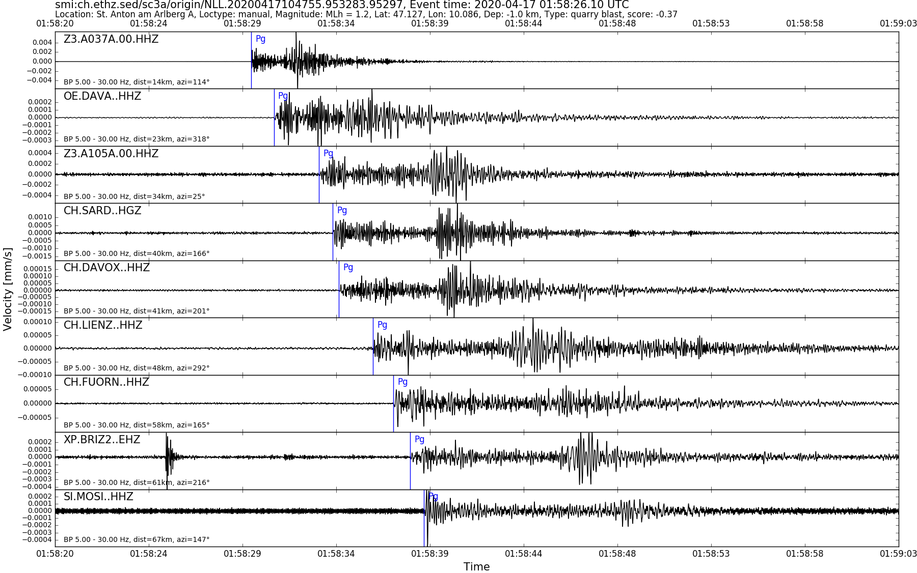
| Local time | 2020-04-17 03:58:26 |
|---|---|
| UTC Time | 2020-04-17 01:58:26 |
| Event Type | earthquake |
| Latitude / Longitude | 47.13 / 10.09 |
| Swiss Coordinates | 800873 / 222950 |
| Magnitude | 1.2 |
| Magnitude Type | MLh |
| Location | St. Anton am Arlberg A |
| Depth [km] | -1.0 |
| Location Type | manual |
| Agency | SED |
| Last Update | 17-04-2020 10:47:58 |
| Danger level | 0 (as defined by federal agencies with responsibility for natural hazards) |
| Origin ID & Metadata | smi:ch.ethz.sed/sc3a/origin/NLL.20200417104755.953283.95297 |
|
GSE 2.1 provisional format |
|---|
| BEGIN GSE2.1 MSG_TYPE DATA MSG_ID 2020/04/17_020236716 CHE_NDC DATA_TYPE BULLETIN GSE2.1:short Reviewed Event Bulletin (REB) of the CHE_NDC for April 17, 2020, 01:58:27.405 EVENT 2020/04/17_015827405 ST. ANTON AM ARLBERG A Date Time Err RMS Latitude Longitude Smaj Smin Az Depth Err Ndef Nsta Gap mdist Mdist Qual Author OrigID 2020/04/17 01:58:27.41 0.13 47.1205 10.0864 13666.3 2787.8 197 2.0 7.1 8 8 140 0.22 0.79 a i uk SED -------- Magnitude Err Nsta Author OrigID MLh 1.4 0.2 6 SED -------- Sta Dist EvAz Phase Time TRes Azim AzRes Slow SRes Def SNR Amp Per Qual Magnitude ArrID DAVA 0.22 319.5 P 01:58:31.418 -0.5 ___ a__ -------- A105A 0.32 25.4 P 01:58:33.770 0.0 ___ 103.4 a__ MLh 1.5 -------- DAVOX 0.37 201.9 P 01:58:34.770 0.0 ___ 58.4 a__ MLh 1.4 -------- LIENZ 0.44 293.3 P 01:58:36.355 0.0 ___ 50.0 a__ MLh 1.5 -------- PLONS 0.48 261.6 P 01:58:36.830 -0.1 ___ 18.9 a__ MLh 1.1 -------- FUORN 0.52 165.6 P 01:58:37.510 0.0 ___ 21.6 a__ MLh 1.2 -------- SGT04 0.55 294.4 P 01:58:38.955 0.3 ___ 38.6 a__ MLh 1.5 -------- WGT 0.79 268.4 P 01:58:44.170 1.2 ___ a__ -------- STOP |