Press tab to activate screen reader mode
  • Home
  • Language
  • Navigation menu
  • Search
  • Plain language
  • Content
  • Contact
MENU
Swiss Seismological Service logo ETH logo
DE EN FR IT
Plain language
DE EN FR IT
×
  • Home
  • Earthquakes
    • Switzerland
    • Europe
    • World
    • Maps
    • Report an earthquake
    • What to do?
      • Behavioural recommendations
      • Earthquakes abroad
      • Earthquake-resistant construction
      • Earthquake insurance
    • Always informed
      • Alerting
      • Receive information
      • Rapid impact assessment
      • ShakeMap
      • Earthquake announcements
  • Monitoring
    • Measuring earthquakes
    • National seismic network
    • Special networks
      • Overview
      • Geothermal energy Haute-Sorne
      • Geothermal energy Yverdon-les-Bains
      • Geothermal energy Geneva Basin
      • Geothermal energy Vinzel
      • Geological repository Northeastern Switzerland
      • Monitoring of the Borehole Basel-1
      • Past projects
    • Realtime seismograms
      • Last 5 minutes
      • Last 20 minutes
      • Last 2 hours
      • Last 24 hours
    • Setup of a monitoring station
    • Nuclear test ban treaty monitoring
  • Earthquake country Switzerland
    • Overview
    • Hazard
      • Overview
      • Components
      • Earthquake hazard model
    • Risk
      • Overview
      • Components
      • Earthquake risk model
      • Earthquake risk tool
    • Earthquake scenarios
    • Earthquake regions
      • Grisons
      • Valais
      • Basel
    • Historical earthquakes
      • The ten strongest
      • Basel 1356
      • Sierre 1946
    • Earthquake swarms
      • Introduction
      • Sarnen 1964
      • Diemtigen 2014 - 2015
  • Knowledge
    • Causes of earthquakes
      • In general
      • In Switzerland
      • In Europe
      • Induced earthquakes
    • Effects of earthquakes
    • Earthquake prediction
    • Earthquake data & web portals
      • Overview
      • Earthquake monitoring software
      • Station information
      • Earthquake catalogues
      • Waveform data
      • FDSN web services
      • Earthquake early warning
      • ShakeMap
      • Software archive
    • Geothermal energy & earthquakes
      • Geothermal energy in brief
      • Forms of geothermal energy
      • Geothermal energy & induced earthquakes
      • Measures to control induced seismicity
      • Geothermal energy in Switzerland
      • Geothermal energy and the SED
      • Seismological consulting (GEOBEST2020+)
      • Fracking
    • Quakes on Mars
    • Frequently asked questions (FAQ)
  • Research & teaching
    • Projects
    • Publications
    • Teaching & training
    • Schatzalp Workshop 2025
  • News & services
    • News articles
      • 2025
      • 2024
      • Archive
    • For schools
    • Brochures
    • Quiz
    • Videos & games
    • Earthquake simulator
    • Earthquake literature
  • About us
    • Contact & media enquires
    • Portrait
      • Tasks & organisation
      • History
      • Independence & transparency
    • Sections
    • All employees
    • Careers
    • Cooperations
    • Intranet
The content of the page starts here

Lake sediments as archive of paleoearthquakes in Switzerland
  • Overview
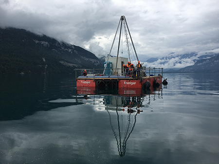
Project image

Earthquake can initiate subaquatic mass transport and sediment deformation structures, the deposits of which are stored in the sedimentary archive. Due to their good preservation potential and improving dating methods, these earthquake-related deposits in the sedimentary archive of lakes can extend the earthquake catalogue back to prehistorical times. The determination of frequency, epicentre and magnitude of these paleoearthquakes can be a key input for improving a probabilistic seismic hazard model, especially in areas such as Switzerland where strong earthquakes have long recurrence rates and might not be recorded in historic times. In order to better interpret the prehistorical earthquake-related sedimentary record, it remains important to understand which historical earthquakes did trigger mass transport deposits and sediment deformation structures, and which earthquakes did not trigger secondary sedimentary effects in the lake basins.

The proposed project is aimed to improve our understanding of which earthquakes, or what kind of shaking, leave traces in the sediments, in order to evaluate the completeness of the sublacustrine paleoseismological record, using Lake Thun as example. The second aim of this project, directly linked to the first one, is to compare the paleoseismological record with the contemporary national seismic hazard model of Switzerland, updated in 2015. Thus, using the intensity ranges determined in the first part of this project and using the paleoseismic database of Switzerland a systematic analysis of frequencies, sources and magnitudes of possible paleoearthquakes will be compared to time series produced by the seismic hazard model of Switzerland.

Project Leader at SED

Dr. Katrina Kremer

Funding Source

SNF, Marie Heim-Vögtlin programme

Duration

2.2017-1.2019

Keywords

Lake sediments, paleoseismology, sublacustrine slope failure

Research Field

Historical Seismicity, Paleoseismology

Website https://tsunami.ethz.ch

Swiss Seismological Service
Sonneggstrasse 5
CH-8092 Zurich
Phone SED secretariat
+41 44 633 21 79 (during office hours)

Imprint | Disclaimer  | ©2024 ETH Zurich