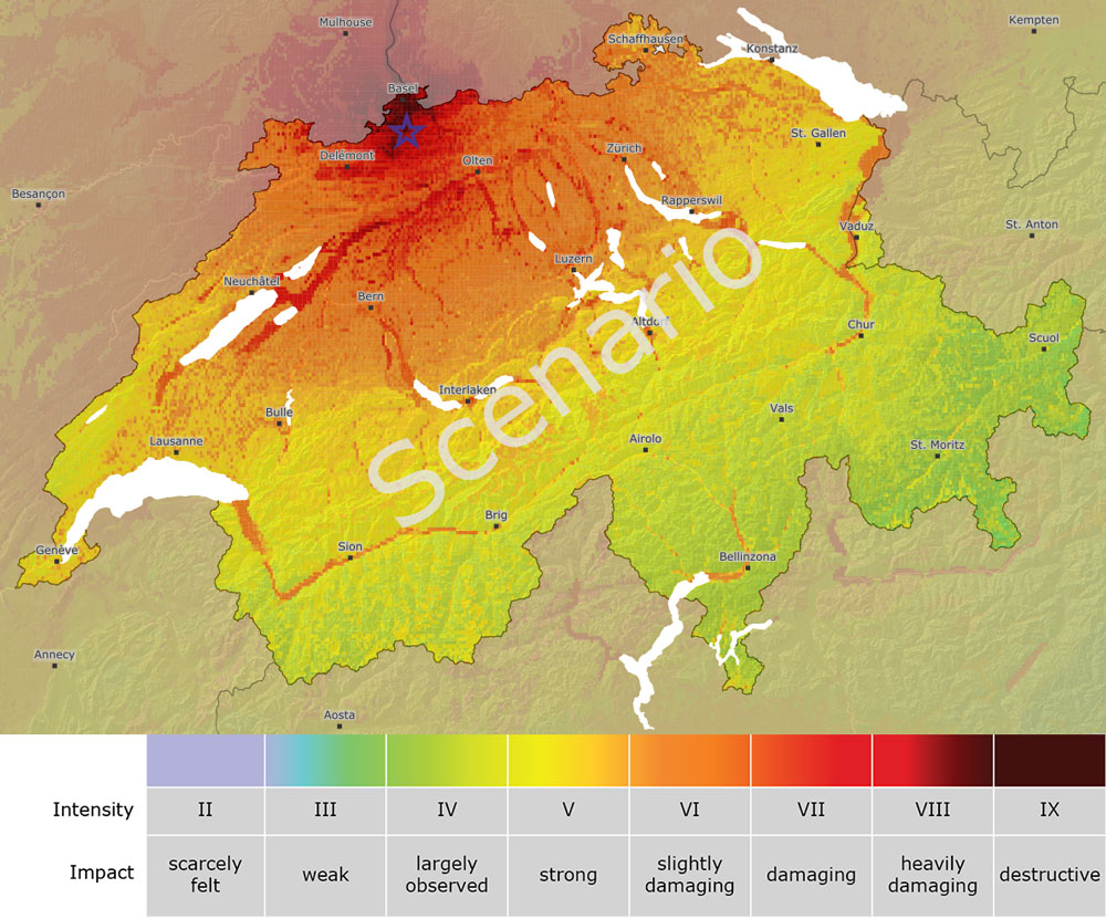
Strong earthquakes cause a great deal of human suffering and enormous damage to buildings and other infrastructure. Immediately following a large earthquake, it is difficult to gain an overview of the situation in order to facilitate initiation of the appropriate measures. ShakeMaps support crisis management during this phase by indicating which areas are especially hard hit. They thereby help authorities and rescue workers target deployment of their resources and serve as a useful source of information. They show where and how intensely the earthquake was felt, as well as whether damage is to be expected. ShakeMaps originated in Southern California and are now used routinely in many earthquake-prone countries.
The creation of a ShakeMap involves several processing steps: First, the epicenter and magnitude of the earthquake are determined from the real-time data recorded by Switzerland’s broadband seismic stations. This information is then combined with the observed maximum ground accelerations at the stations of the strong motion network and with values of the ground shaking based on historical measurements. Before the data is processed to determine macroseismic intensity (EMS-98), it is necessary to filter out local amplification effects. The models that are necessary for calculating ShakeMaps were calibrated especially for Switzerland.