The key factor in determining peak ground acceleration (PGA) and peak ground velocity (PGV) is the horizontal ground movement caused by an earthquake and recorded at the Swiss Seismological Service’s measuring stations. Both peak ground acceleration and peak ground velocity can be depicted on a ShakeMap (see “What are ShakeMaps?”).
Peak ground acceleration and peak ground velocity values are crucial for producing seismic hazard maps used to draw up construction standards for earthquake-resistant structures.
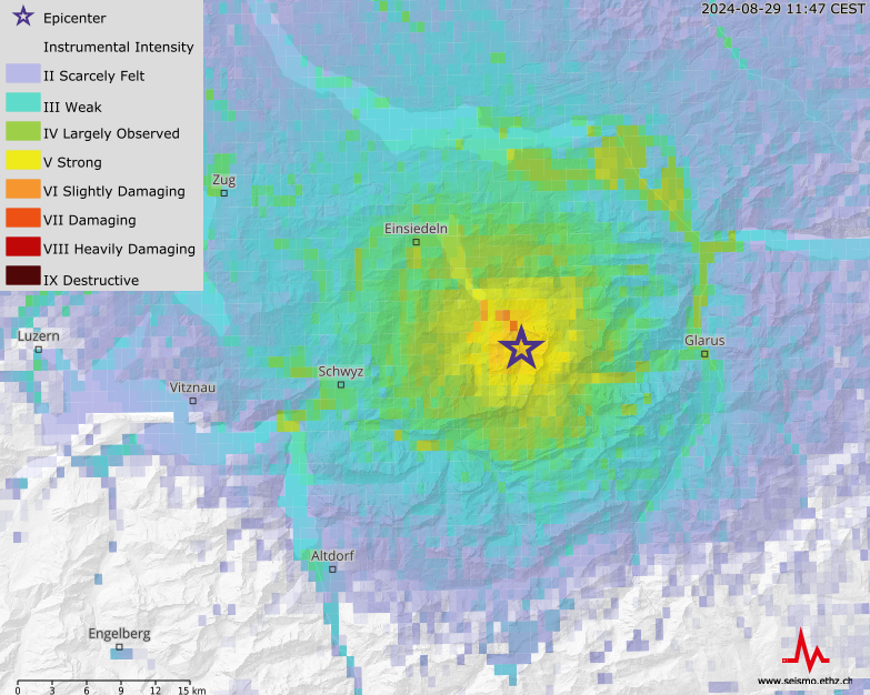
Both peak ground acceleration and peak ground velocity depend on several factors: the length and direction of the fault (and thus the magnitude of the earthquake: see “What is a fault and what is a rupture surface?”), the distance between the measuring station and the epicentre, and the geology of the subsoil in the area concerned. Even small variations in the subsoil beneath measuring stations can affect ground acceleration significantly. As a result, the ground acceleration values recorded for a single quake can vary considerably from one small area to the next. As a general rule, the greatest velocity and acceleration values will be recorded near to the epicentre and in the direction of fault propagation. The higher the acceleration value and/or velocity, the greater the likelihood of damage. In the case of small quakes (i.e. of a magnitude of less than 3), what the local population feels is the acceleration (Wu et al., 2003). By contrast, damage to buildings generally correlates to the ground velocity.
Peak ground acceleration is measured in m/s2 or as a fraction or multiple of the Earth’s gravitational acceleration (g = 9.81 m/s2). Peak ground velocity is measured in m/s.
The Swiss Seismological Service has been recording peak ground acceleration and peak ground velocity during earthquakes since 1992. The highest peak ground acceleration recorded to date was that of 2.13 m/s2 during a magnitude 3.4 earthquake in Linthal in the canton of Glarus that occurred on 17 March 2001. The highest ever peak ground velocity of 3.6 cm/s was also recorded during the Linthal quake. The measuring station at which these values were recorded was located approximately 730 m from the epicentre.
Learn more
ShakeMap of an earthqake near Elm on November 10, 2020 with magnitude 3.9. The hypocentre was located at a depth of about 1.7 kilometers.