Estimation of an earthquake hazard level indicates where and how often within a given time period certain instances of horizontal acceleration are likely to occur. It is based on tectonic, geological and historical earthquake knowledge, and wave propagation models.
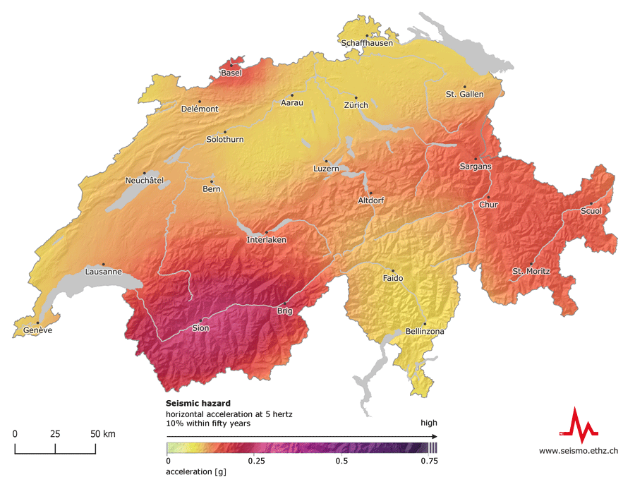
Compared to the rest of Europe, Switzerland faces a moderate earthquake hazard. However, earthquake activity is not distributed evenly nationwide: the canton of Valais is prone to the highest hazard level, followed by Basel, Grisons, the St. Gallen Rhine Valley, Central Switzer-land and then the rest of the country. There are no regions without any earthquake hazard.
Experts and authorities base their decisions on earthquake mitigation and risk management measures on the SED's seismic hazard model, which also underpins the Swiss Seismic Building Code.
Earthquake-resistant residential or office buildings in Switzerland are designed to withstand shaking that is expected to occur where the building is situated once every 500 years on average. The lifetime of a building is approximately fifty years. Within this period, the probability of a residential or office building experiencing the design shaking is ten percent (10 % within 50 years).
Learn more
The earthquake hazard map illustrates the horizontal acceleration at 5 hertz; the probability of a building constructed on rocky subsoil experiencing this is 10 % within fifty years.