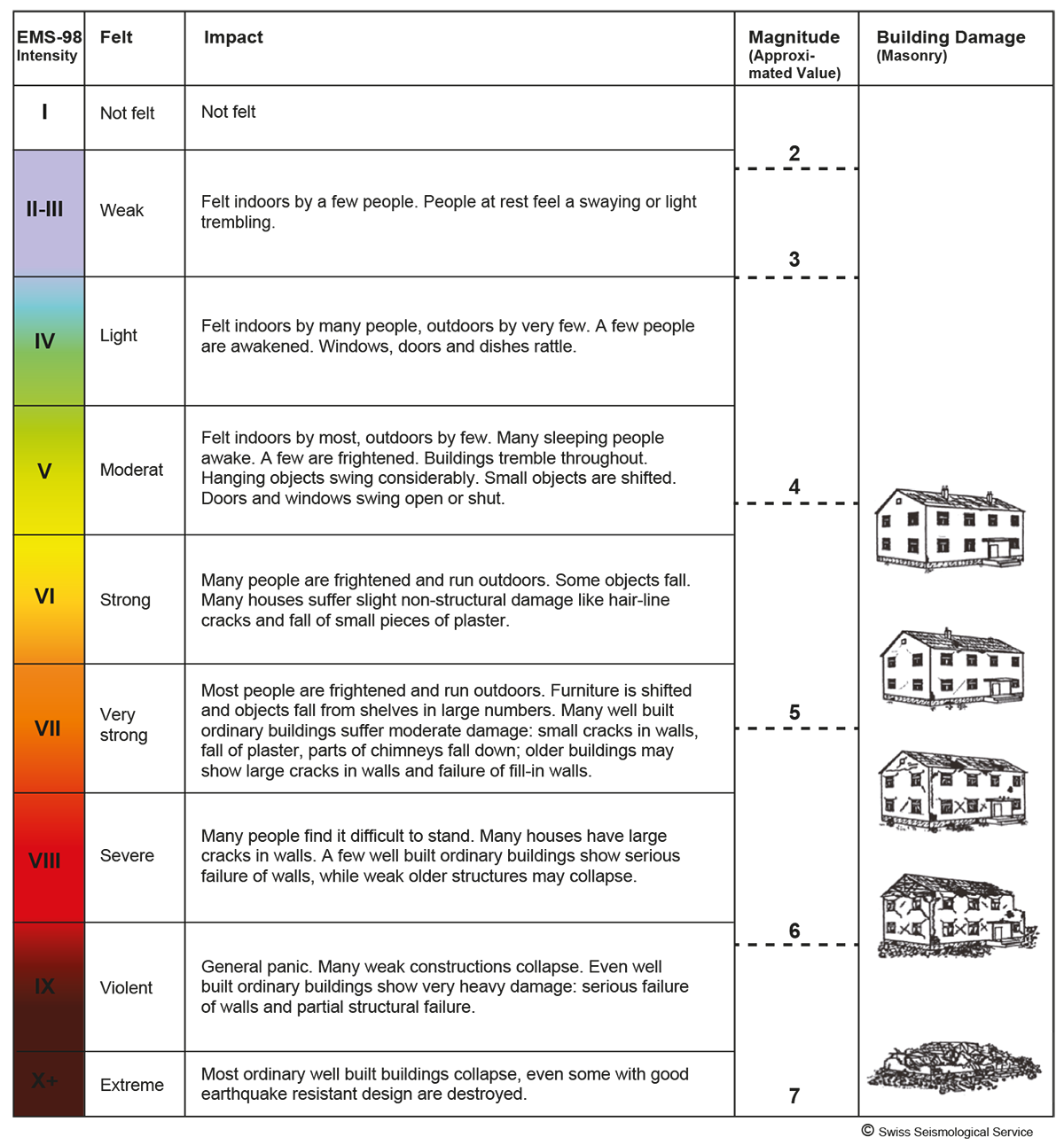
The intensity describes the strength of an earthquake based on the extent of the destruction (buildings, landscape) and the subjective perception of an observer. The intensity of an earthquake is location-specific and is defined by the magnitude, the distance to the hypocenter and the geology of the subsurface.
The European Macroseismic Scale 1998 (EMS-98) uses numbers between I (not felt) and XII (complete destruction) for the individual classification of earthquakes.
Nowadays, determining the intensity can be done instrumentally as well by looking at the peak ground velocities and accelerations at a station, among other considerations. In this way an overview of the distribution of ground movements in an area can be attained much quicker than by questioning the affected population and by damage evaluation, which are needed in the classical approach to creating an intensity map. The values can be displayed as dots on a map and / or they can be connected to form contours (ShakeMaps).
Learn more
Potential consequences of earthquakes of different intensities and magnitudes