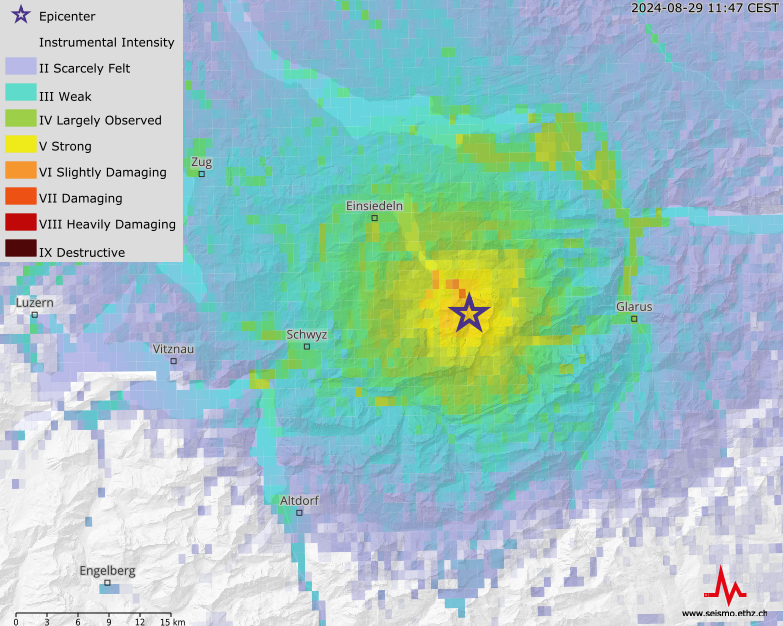
For every earthquake with a magnitude of 2.5 or greater, the Swiss Seismological Service (SED) publishes both a map of ground shaking and a ShakeMap. These provide an overview of the ground motion and anticipated impact of an earthquake. ShakeMaps supply considerably more information than standard earthquake maps, which typically show only the epicentre and magnitude. ShakeMaps' additional details are useful to those affected by ground shaking as well as to rescue workers, who can use them as a basis for further action.
In addition to ShakeMaps depicting earthquake intensity, there are also some that show peak ground acceleration (PGA) and peak ground velocity (PGV) (see "What are peak ground velocity and peak ground acceleration?"). These data are particularly important for civil engineers.
Learn more
ShakeMap of an earthqake near Elm on November 10, 2020 with magnitude 3.9. The hypocentre was located at a depth of about 1.7 kilometers.