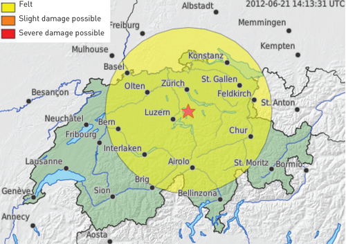
A map of ground shaking is created prior to the creation of the ShakeMap for every earthquake with a magnitude of 2.5 or greater. The colored circle on the map of ground shaking shown below from the 2012 Zug earthquake indicates the regions in which the earthquake was likely felt (yellow). The map of ground shaking is a simplified form of a ShakeMap and it may be produced faster than ShakeMaps. It indicates the area around the epicenter in which the earthquake is presumed to have been felt and suggests an initial damage estimate. Unlike the ShakeMap, the map of ground shaking takes neither the effects of the local subsurface nor the ground shaking actually measured by seismometers into account. It is based solely on the automatic earthquake location and the magnitude. The expected ground shaking is based on observations from past earthquakes in Switzerland.