Overview
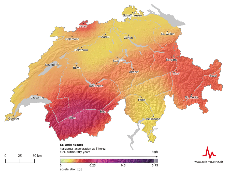
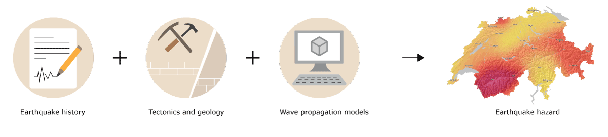
Earthquake hazard shows how often and how intensely the earth could shake at a given location in the future. Switzerland’s earthquake hazard model is based on knowledge of tectonics and geology, information about the history of earthquakes, damage reports, and wave propagation models. Experts and authorities use it as a starting point when making decisions regarding earthquake mitigation and risk management. The Swiss seismic building codes are also based on this model.
What is shown on the earthquake hazard map of Switzerland?
The earthquake hazard map illustrates the horizontal acceleration at 5 hertz; the probability of a building constructed on rocky subsoil experiencing this is 10 % within fifty years.