2017-01-22
No Earthquake Near Samnaun: What Triggers False Alerts
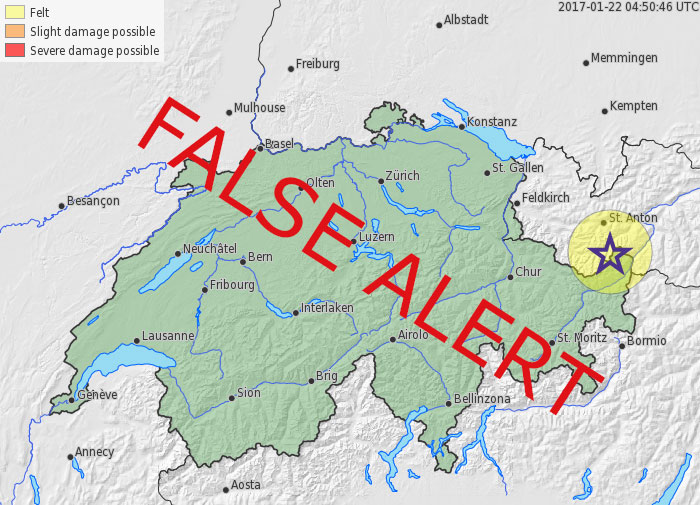
On Sunday, 22 January 2017, based on fully automated evaluations, the Swiss Seismological Service erroneously reported an earthquake with a magnitude of 3.3 that was supposed to have happened near Samnaun in the canton of Graubünden at 5.48 a.m. During the ensuing routine control by a seismologist, it quickly became clear that the algorithm that is supposed to automatically detect and localize earthquakes had got things a bit muddled up. The seismic waves of a very large and deep earthquake in Papua New Guinea were mistaken for an earthquake in Switzerland. The earthquake notification was quickly corrected, and the media and authorities were notified that it was a false alert. Automation errors of this kind occur every few years in all seismic networks. Unfortunately, these false alerts cannot be completely avoided. That is why we would like to provide the following explanation.
Read more...Earthquakes happen without any prior warning, and their waves travel at a speed of a few kilometers per second. A larger local earthquake is, therefore, felt within 30 to 40 seconds throughout Switzerland and creates uncertainty: What was it? How strong was it? Where did the vibrations occur? In order to make this information available in seconds, our computers continuously scan the data from more than 150 seismometers, which record ground movements across Switzerland. As the ground often “shakes” at one station when, for instance, a truck drives past, the algorithm requires the seismometers to detect a significant increase above the signal-to-noise ratio at several stations simultaneously (i.e. within a few seconds). Only then does the computer suspect an earthquake. It subsequently determines its origin by using a kind of cross bearing and its magnitude using the measured amplitude of the signal. This works in 99.9 percent of cases and enables us to provide information within one minute by e-mail, Twitter, and the Internet.
Sometimes, however, things can go wrong: In today’s case, an earthquake in Papua New Guinea confused our computers. At 5.30 a.m., the earth cracked at a depth of more than 130 kilometers along a rupture surface 100 to 150 kilometers long, resulting in a large earthquake with a magnitude of 7.9. As it happened deep in the earth, hopefully no one was injured. The earthquake waves spread across the entire globe, and after around 18 minutes, they also reached Switzerland (watch this short video, only available in German). The first waves hit Switzerland almost vertically from below and were, therefore, recorded at the almost same time at all stations. Our computers correctly detected an earthquake, but determined it originated 60 kilometers below the Engadine. The quality of localization was classified as not particularly good by the software, but it was just good enough to reach the prescribed threshold value for the issuing of the alert. Fortunately, the magnitude was estimated as being far smaller, as the energy of the waves had already weakened considerably on their long journey from Papua New Guinea to Switzerland. Thus, the notification of a Swiss earthquake was sent out into the world – although accompanied by the warning that it was an automatic localization that had not been confirmed by a seismologist.
We could further reduce the risk of such false alerts, but this would have consequences. Stricter automatic quality criteria would be helpful, but it would also increase the risk of missing and not reporting an earthquake (for us, this would be at least as bad as a false alert). We could have all earthquakes verified first by a seismologist, but that would take at least 20 to 30 minutes – a long time in the age of online media. Therefore, all we can do as seismologists is apologize when something goes wrong (and we do indeed apologize again here), continue refining the algorithms of our automated alerts, and, last but not least, share this comforting thought with you: computers cannot do everything better than humans (yet?).