2021-11-23
Using ambient noise to uncover three billion years of Mars's past
There are two ways to find out what lies deep beneath our feet: you can either drill a hole, or you can use seismic waves to create an image of the subsurface. In recent decades, seismologists have developed and improved techniques that use ambient noise to map structures in the near-surface layers down to a depth of several hundred metres. Using technologies tested on Earth, seismologists have now mapped structures on another planet for the very first time. These analyses provided a glimpse into three billion years of Mars's past, as detailed in a study recently published in Nature Communications.
Read more...Since NASA's InSight mission landed on Mars in November 2018 and installed a seismometer, the Marsquake Service, led by ETH Zurich and involving the Swiss Seismological Service (SED), has been regularly analysing the recorded seismic data. In addition to identifying numerous marsquakes, researchers used these data to make statements about the structure of the planet's interior. They built a profile of the planet's crust, mantle and core but could not yet reveal much about the near-surface structures. However, shallow subsurface is vital to understanding Mars's geological history.
Rather than using marsquake signals to look into the subsurface, the new study utilises the ambient noise recorded at times without marsquakes. On Earth, such noise is generated by ocean waves, wind and human activity. Over the past few decades, the SED has developed methods to analyse ambient noise. These methods are used to define the structure of the local geology and to determine whether the local subsurface tends to attenuate or amplify seismic waves. This information is crucial for determining a site's earthquake hazard and analysing unstable landslide zones on mountains or in lakes.
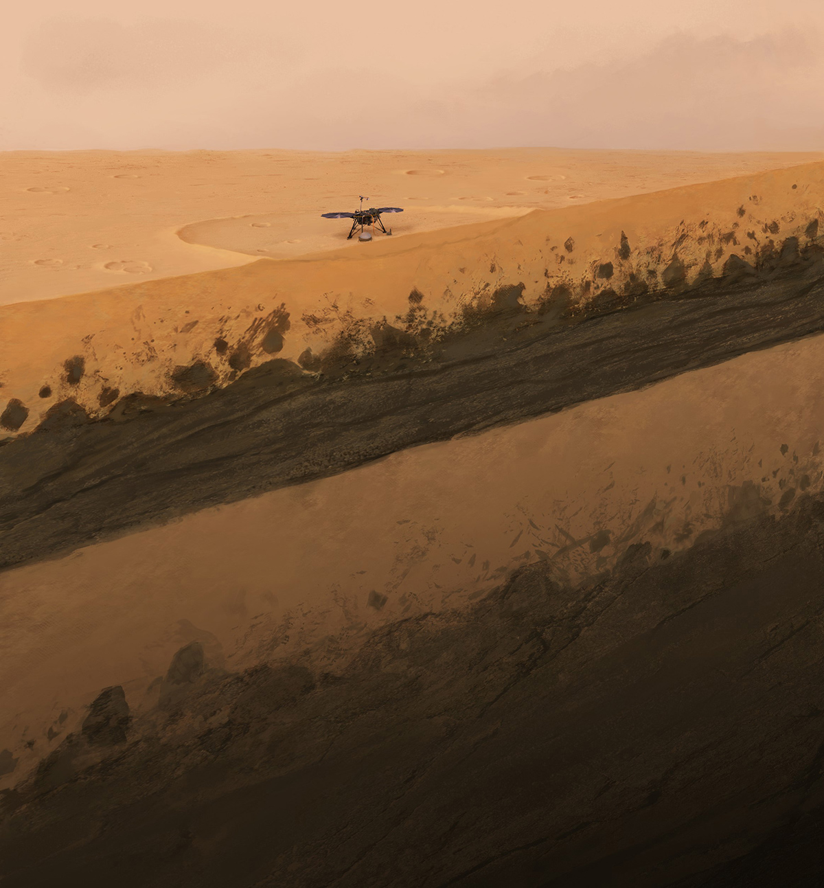
On Mars, ambient noise is triggered by the wind, which generates seismic waves when interacting with the planet's surface. Based on analyses of this ambient noise, researchers can now image for the first time the shallow subsurface of Mars and study its geological history at depths ranging from a few dozens to two hundred metres. In contrast to Earth, Mars has never been home to any active plate tectonics. The planet has been shaped by phases of active volcanism that covered large areas with basaltic lava plateaus. The new analyses provide now a detailed image of the subsurface at the InSight landing site and show a top layer of three meters sand (regolith) and loose rock about 20 metres thick that has been fissured by thousands of meteorite impacts. Below are layers of lava flows that covered the planet between 1.7 and 3.6 billion years ago. These lava layers are divided by sediments lying at around 30 to 75 metres deep. The seismic image of the layer-cake geological stratification allows researchers to trace, for the very first time, the most important geological events that have occurred at the InSight landing site on Mars over the last three billion years.
When humans land on Mars one day, they need to know what lies under their feet. The question of whether these near-surface layers contain water is, for example, particularly interesting. The results of this latest study demonstrate that established techniques to investigate Earth are helping to answer such questions on Mars.
