2017-06-26
Landslide and Flood in Greenland
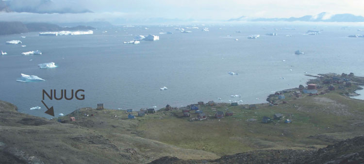
On Saturday evening on 17 June 2017, a large landslide occurred in northwestern Greenland, around 20 km from the small fishing village of Nuugaatsiaq. Shortly afterwards, waves inundated much of the village, producing widespread destruction - 11 houses were swept out to sea, and four people are missing; in total 200 people have been evacuated from three villages in the region. The slide generated seismic energy visible across the globe, and lit up all stations from the GLISN seismic network, built through an international effort over the last decade with significant funding from the US National Science Foundation, Geological Survey of Denmark and Greenland, Swiss National Science Foundation (SNSF), and eight other international partners.
Read more...Seismic data have provided important early constraints on the slide event. A key station is NUUG, in the village of Nuugaatsiaq, one of the three stations in northwestern Greenland built and operated by the Swiss Seismological Service with the support of SNSF. These stations not only recorded the landslide signal but also the sea waves inundating the village as a result of the fjord seiche. Additional information about the landslide signals can be found here.