Strong Motion Seismology and Site-Specific Effects
In a bid to improve the analysis of the seismic hazard facing Switzerland, by 2019 the Swiss Seismological Service (SED) aims to have renewed its Swiss National Strong Motion Network (SSMNet). Each station will take geophysical and geotechnical measurements to determine the properties of the local geological underground, enabling us to interpret any features captured on earthquake recordings. To this end, we developed special measurement procedures, some of which are based on analysing seismic noise.
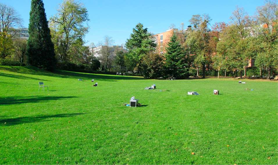
Illustration: Design for a free-field installation

Renewing the National Strong Motion Network
The Swiss Federal Council has approved funding for 100 new stations to measure strong ground motion (project Renewal of the Swiss Strong Motion Network). This network will also be expanded by other projects, e.g. in the Basel region and in Liechtenstein, and will serve to record strong earthquakes with a magnitude higher than 2.5. The stations in question will be in areas with a high seismic risk, especially in larger agglomerations and locations that have suffered earthquake damage in the past. At some sites, where soil liquefaction can be expected to occur, instruments will also be placed in deep boreholes, to calibrate numerical models.
The measurements taken will provide information on the local underground and thus prove useful for analysing seismic hazards. Amplification effects will be calculated after each earthquake, and the data will be used for microzonation and for verifying numerical models.
In the event of an earthquake, real-time data can be processed to produce ShakeMaps that serve to predict damage and brief the emergency services, and are also used by seismologists, engineers and insurance companies as a basis for assessing events and updating existing construction standards.
Influence of the Local Underground and Measurement of its Properties
Compared with solid, rocky ground, soft soil in river valleys can amplify seismic tremors by a factor of up to ten. Some water-saturated soils can also liquefy, losing their load-bearing capacity.
When selecting sites for measuring stations, their geology and potential sources of interference are considered, as is the variability of the geological underground in the target area. The underground's resonance frequency and S-wave profile are determined on site using passive seismic methods. If the properties of the underground prove highly variable, active seismic measuring techniques are also applied. Sites characterised by expected non-linear properties, such as soil liquefaction, are additionally investigated using geotechnical methods, such as cone penetration tests (CPTs). Knowing both the local geology and the wave field at sites for measuring stations is important for ensuring that the data collected there are optimally useful for hazard analysis.
New Measurement Methods When Evaluating Sites
Key parameters when evaluating sites are their underground shear-wave velocity, the thickness and composition of unconsolidated sediments, properties of the water table, and the topography of the rock surface and local terrain. All these factors influence wave behaviour and can amplify earthquake effects.
The most important aspects to consider when analysing seismic hazards are the resonance frequency of loose sediments and the underground shear-wave velocity profile. The values of these properties can be determined using active methods, like reflection and refraction seismics, or by taking passive measurements of seismic tremors generated by such phenomena as sea surf, wind or human activity. Since active methods can often not be applied in urban environments, passive alternatives play a particularly important role there. The SED has devised a number of measurement methods in the past and will continue to develop new procedures in the future, using naturally occurring seismic tremors to determine shear-wave velocity profiles in densely populated areas.
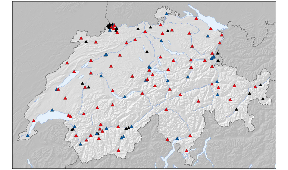
Blue: Phase 1 of the SSMNet renewal project (2009-2013), 30 installed stations.
Red: Phase 2 of the SSMNet renewal project (2013-2019), 70 planned stations whose final locations have not yet been decided.
Black: 37 free-field strong motion measuring stations not included in the renewal project, designed for specific, local studies.
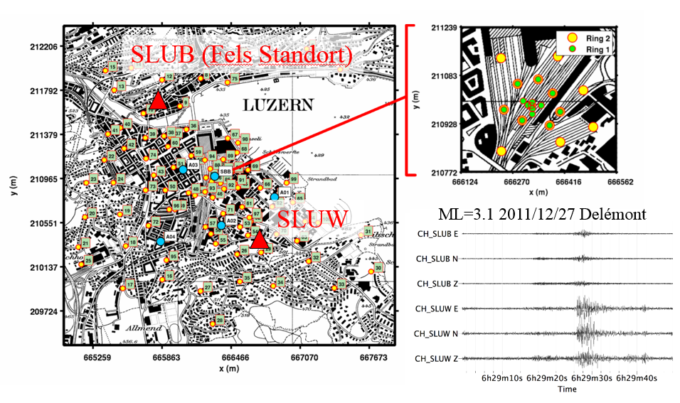
Coloured dots indicate places where geophysical measurements were taken in the city of Lucerne.