Earthquake-Induced Phenomena
Earthquakes are not the only events that cause damage to buildings and infrastructure: secondary earthquake-induced phenomena can wreak havoc as well, for example through soil liquefaction, landslides and tsunamis triggered by undersea landslides. Accordingly, one aim of our earthquake research is to characterise such phenomena with a view to seismic hazard analysis and the recognition of early indications of mass wasting (ground movements) based on giveaway seismic signals. Other phenomena to watch for are short-term foreshocks prompted by processes in the Earth's crust, which can produce characteristic electromagnetic and geochemical signals.
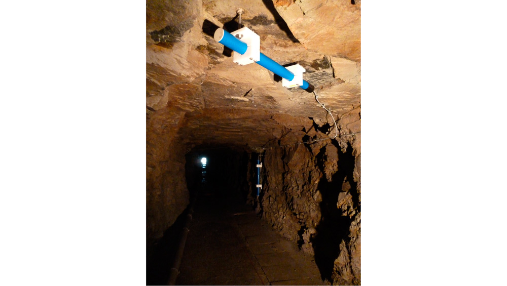
Illustration: Installing the borehole measuring station in Visp, which was fitted with strong motion sensors, pressure sensors and a 'shape array'.

Soil liquefaction
Earthquake motions tend to trigger a non-linear reaction in water-saturated silts and sands, which in extreme cases will liquefy, thereby losing their load-bearing capacity. The Swiss Seismological Service (SED) pinpoints such locations by taking extensive geophysical measurements, and - where possible - installs permanent borehole sensors on site to determine amplification effects and measure how material behaves in the linear and non-linear domains (project "Site Characterization Group"). The findings can then be compared with model-based predictions (field of research "Numerical Modeling". The results constitute one of the most important bases for realistically assessing the risks of the consequences of soil liquefaction and relative ground motions deep below the surface.
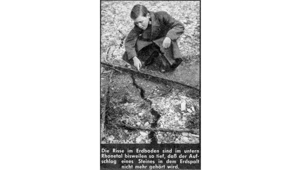
Landslides and Rockfalls
Earthquake-induced landslides can cause tremendous damage. Currently, slope instability is assessed using pseudo-statistical methods, though this approach only takes limited account of dynamic processes. Seismic measurements derived through procedures based on observations of natural seismic tremors and small earthquakes can make an important contribution in this connection. The goal of our scientific research is to develop and deploy inexpensive methods of assessing unstable areas, determine the extent of their instability and characterise their dynamic behaviour. A trial monitoring system on the Alpe di Roscioro near Preonzo in Ticino enables the dynamics of local instability to be tracked around the clock.
Automatic Recognition of Mass Wasting
Evaluating seismic data is a valuable alternative to conventional visual observation. The special dynamics of unleashed mass movements produce a characteristic ground motion that can clearly be differentiated from other causes, such as earthquakes or quarry blasts. This specific seismic excitation is automatically recognised using modern, self-learning algorithms. The possibility of spotting mass wasting in real time can enable detailed, well-founded assessments of the risk level faced. Our research projects are geared towards enabling the recognition and swift characterisation of landslides, rockfalls and avalanches.
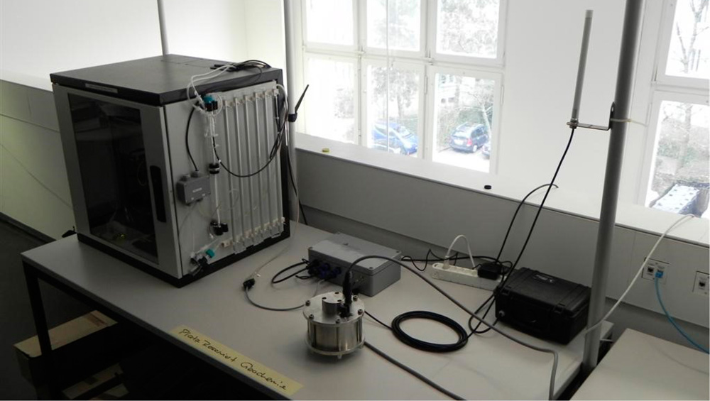
Foreshocks
In an effort to capture data on foreshocks, the SED fitted sensors to a thermal spring whose water comes into contact with a fault system. As a first step, the spring water was monitored continuously and magnetic sensors were installed for long-term electromagnetic monitoring. In addition to gathering data over the long term, this project is designed to accumulate experience regarding sensor reliability, maintenance costs and perhaps information on potential foreshocks.
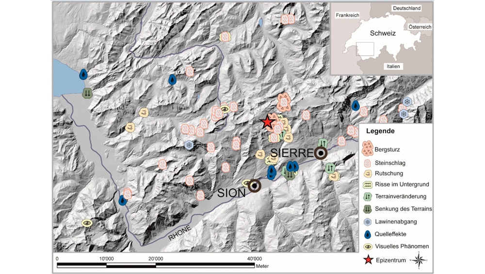
According to Fritsche et al., 2009
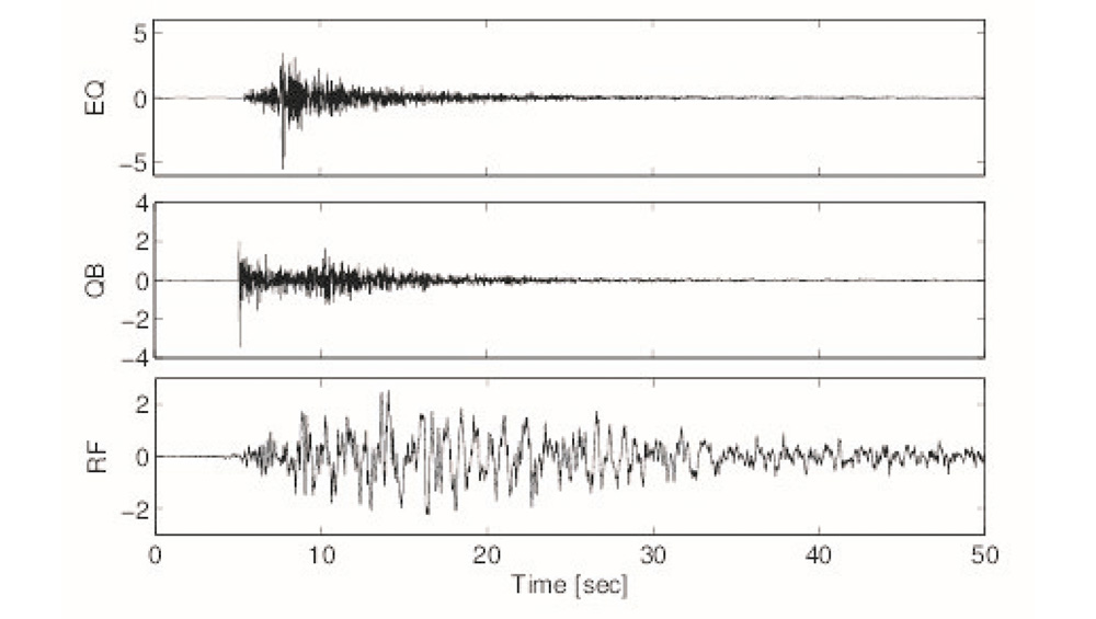
EQ = earthquake, QB = quarry blast, RF = rockfall