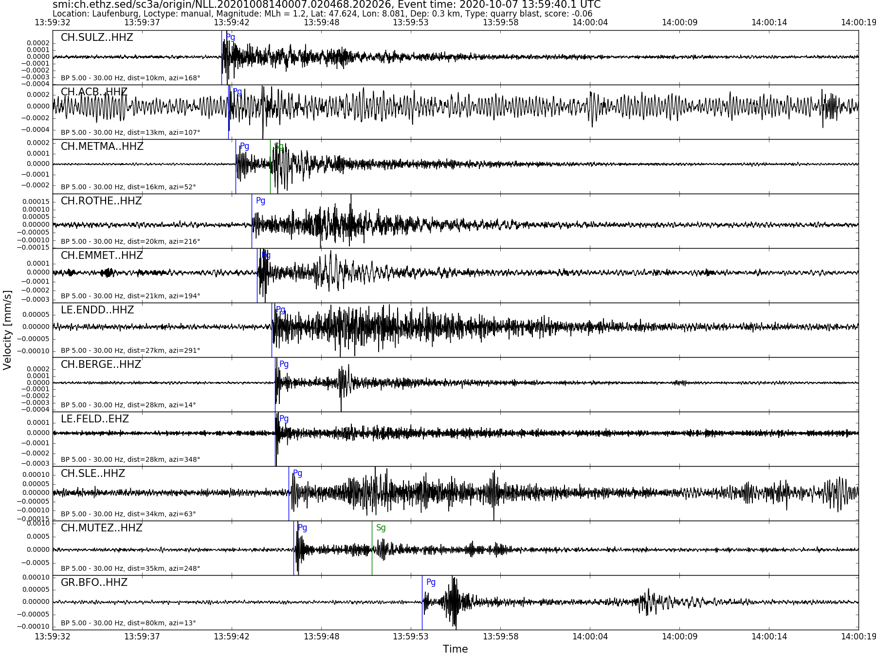
| Local time | 2020-10-07 15:59:40 |
|---|---|
| UTC Time | 2020-10-07 13:59:40 |
| Event Type | quarry blast |
| Latitude / Longitude | 47.62 / 8.08 |
| Swiss Coordinates | 648309 / 274965 |
| Magnitude | 1.2 |
| Magnitude Type | MLh |
| Location | Laufenburg |
| Depth [km] | - |
| Location Type | manual |
| Agency | SED |
| Last Update | 08-10-2020 14:00:11 |
| Danger level | - |
| Origin ID & Metadata | smi:ch.ethz.sed/sc3a/origin/NLL.20201008140007.020468.202026 |